国立情報学研究所 - ディジタル・シルクロード・プロジェクト
| |||||||||
|
| Explorations in Turkestan 1903 : vol.1 | |
| トルキスタンの調査 1903年 : vol.1 |
 |
| クジルオイ盆地とミンヨル盆地の流域Drainage of the Kuzzil Oi and Min Yol basins. |
| RECONNAISSANCE IN CENTRAL TURKESTAN. | 177 |
ridge to the south presents a steep north-facing fault scarp in the central portion, although farther west this merges into a fold.
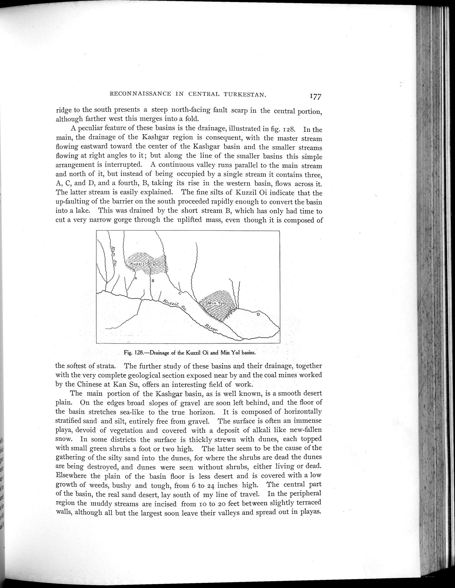
A peculiar feature of these basins is the drainage, illustrated in fig. 128. In the main, the drainage of the Kashgar region is consequent, with the master stream flowing eastward toward the center of the Kashgar basin and the smaller streams flowing at right angles to it ; but along the line of the smaller basins this simple arrangement is interrupted. A continuous valley runs parallel to the main stream and north of it, but instead of being occupied by a single stream it contains three, A, C, and D, and a fourth, B, taking its rise in the western basin, flows across it. The latter stream is easily explained. The fine silts of Kuzzil Oi indicate that the up-faulting of the barrier on the south proceeded rapidly enough to convert the basin into a lake. This was drained by the short stream B, which has only had time to cut a very narrow gorge through the uplifted mass, even though it is composed of
Fig. 128.—Drainage of the Kuzzil Oi and Min Yol basins.
the softest of strata. The further study of these basins and their drainage, together with the very complete geological section exposed near by and the coal mines worked by the Chinese at Kan Su, offers an interesting field of work.
The main portion of the Kashgar basin, as is well known, is a smooth desert plain. On the edges broad slopes of gravel are soon left behind, and the floor of the basin stretches sea-like to the true horizon. It is composed of horizontally stratified sand and silt, entirely free from gravel. The surface is often an immense playa, devoid of vegetation and covered with a deposit of alkali like new-fallen snow. In some districts the surface is thickly strewn with dunes, each topped with small green shrubs a foot or two high. The latter seem to be the cause of the gathering of the silty sand into the dunes, for where the shrubs are dead the dunes are being destroyed, and dunes were seen without shrubs, either living or dead. Elsewhere the plain of the basin floor is less desert and is covered with a low growth of weeds, bushy and tough, from 6 to 24 inches high. The central part of the basin, the real sand desert, lay south of my line of travel. In the peripheral region the muddy streams are incised from Io to 20 feet between slightly terraced walls, although all but the largest soon leave their valleys and spread out in playas.
|
Copyright (C) 2003-2019
National Institute of Informatics(国立情報学研究所)
and
The Toyo Bunko(東洋文庫). All Rights Reserved.
本ウェブサイトに掲載するデジタル文化資源の無断転載は固くお断りいたします。