国立情報学研究所 - ディジタル・シルクロード・プロジェクト
| |||||||||
|
| Explorations in Turkestan 1903 : vol.1 | |
| トルキスタンの調査 1903年 : vol.1 |
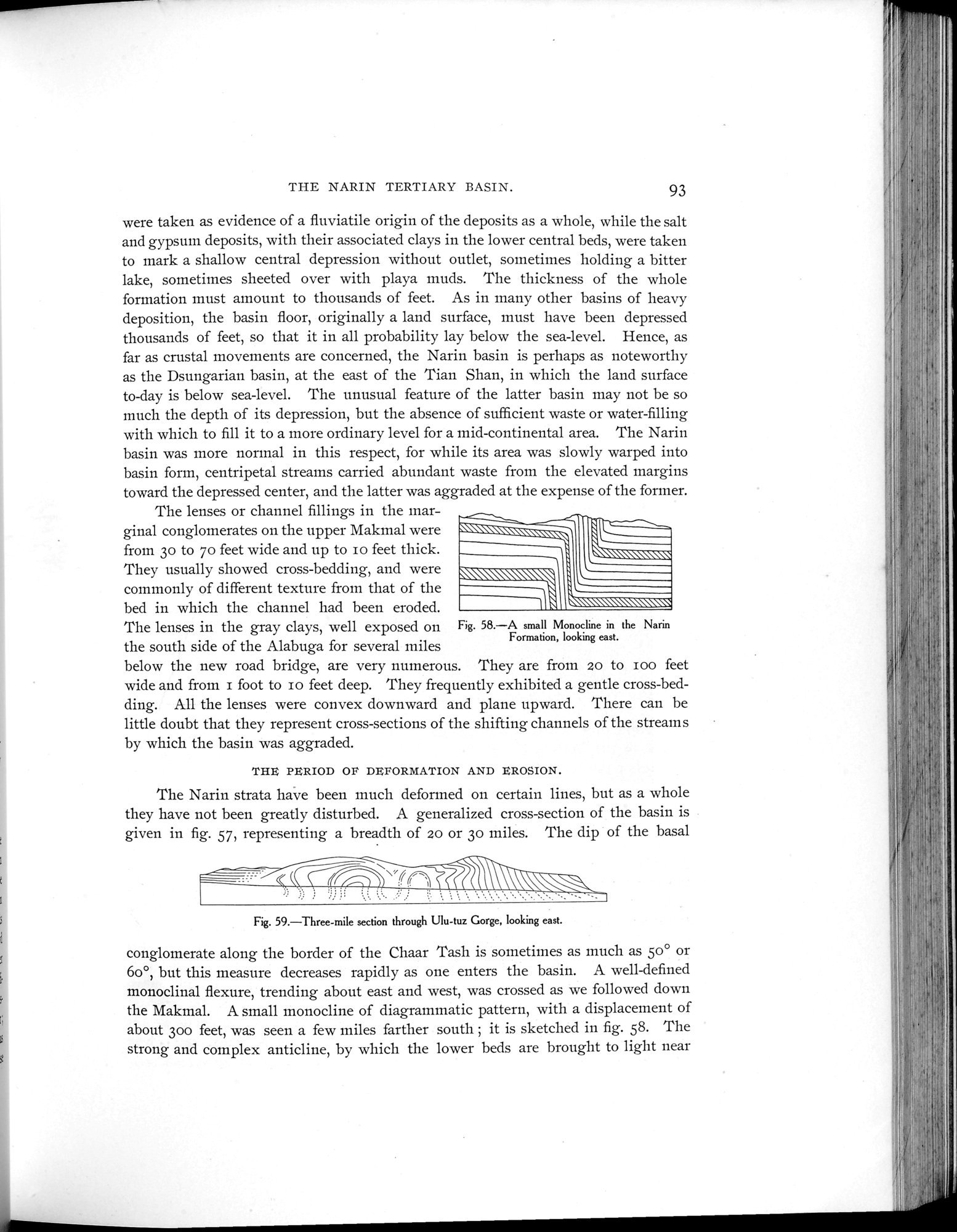 |
| ナリン地層の小規模な単斜 東向きA small Monocline in the Narin Formation, looking east. | |
| Ulu-tuz峡谷を貫く3マイルの断面 東向きThree-mile section through Ulu-tuz Gorge, looking east. |
THE NARIN TERTIARY BASIN. 93
were taken as evidence of a fluviatile origin of the deposits as a whole, while the salt and gypsum deposits, with their associated clays in the lower central beds, were taken to mark a shallow central depression without outlet, sometimes holding a bitter lake, sometimes sheeted over with playa muds. The thickness of the whole formation must amount to thousands of feet. As in many other basins of heavy deposition, the basin floor, originally a land surface, must have been depressed thousands of feet, so that it in all probability lay below the sea-level. Hence, as far as crustal movements are concerned, the Narin basin is perhaps as noteworthy as the Dsungarian basin, at the east of the Tian Shan, in which the land surface to-day is below sea-level. The unusual feature of the latter basin may not be so much the depth of its depression, but the absence of sufficient waste or water-filling with which to fill it to a more ordinary level for a mid-continental area. The Narin basin was more normal in this respect, for while its area was slowly warped into basin form, centripetal streams carried abundant waste from the elevated margins toward the depressed center, and the latter was aggraded at the expense of the former.
The lenses or channel fillings in the marginal conglomerates on the upper Makmal were from 3o to 7o feet wide and up to io feet thick. They usually showed cross-bedding, and were commonly of different texture from that of the bed in which the channel had been eroded.
The lenses in the gray clays, well exposed on Fig. 58.—A small Monocline in the Narin
the south side of the Alabuga for several miles Formation, looking east.
below the new road bridge, are very numerous. They are from 20 to zoo feet wide and from I foot to io feet deep. They frequently exhibited a gentle cross-bedding. All the lenses were convex downward and plane upward. There can be little doubt that they represent cross-sections of the shifting channels of the streams by which the basin was aggraded.
THE PERIOD OF DEFORMATION AND EROSION.
The Narin strata have been much deformed on certain lines, but as a whole they have not been greatly disturbed. A generalized cross-section of the basin is given in fig. 57, representing a breadth of 20 or 3o miles. The dip of the basal
Fig. 59.—Three-mile section through Ulu-tuz Gorge, looking east.
conglomerate along the border of the Chaar Tash is sometimes as much as 5o° or 6o°, but this measure decreases rapidly as one enters the basin. A well-defined monoclinal flexure, trending about east and west, was crossed as we followed down the Makmal. A small monocline of diagrammatic pattern, with a displacement of about 30o feet, was seen a few miles farther south ; it is sketched in fig. 58. The strong and complex anticline, by which the lower beds are brought to light near
|
Copyright (C) 2003-2019
National Institute of Informatics(国立情報学研究所)
and
The Toyo Bunko(東洋文庫). All Rights Reserved.
本ウェブサイトに掲載するデジタル文化資源の無断転載は固くお断りいたします。