National Institute of Informatics - Digital Silk Road Project
| |||||||||
|
| Explorations in Turkestan 1903 : vol.1 |
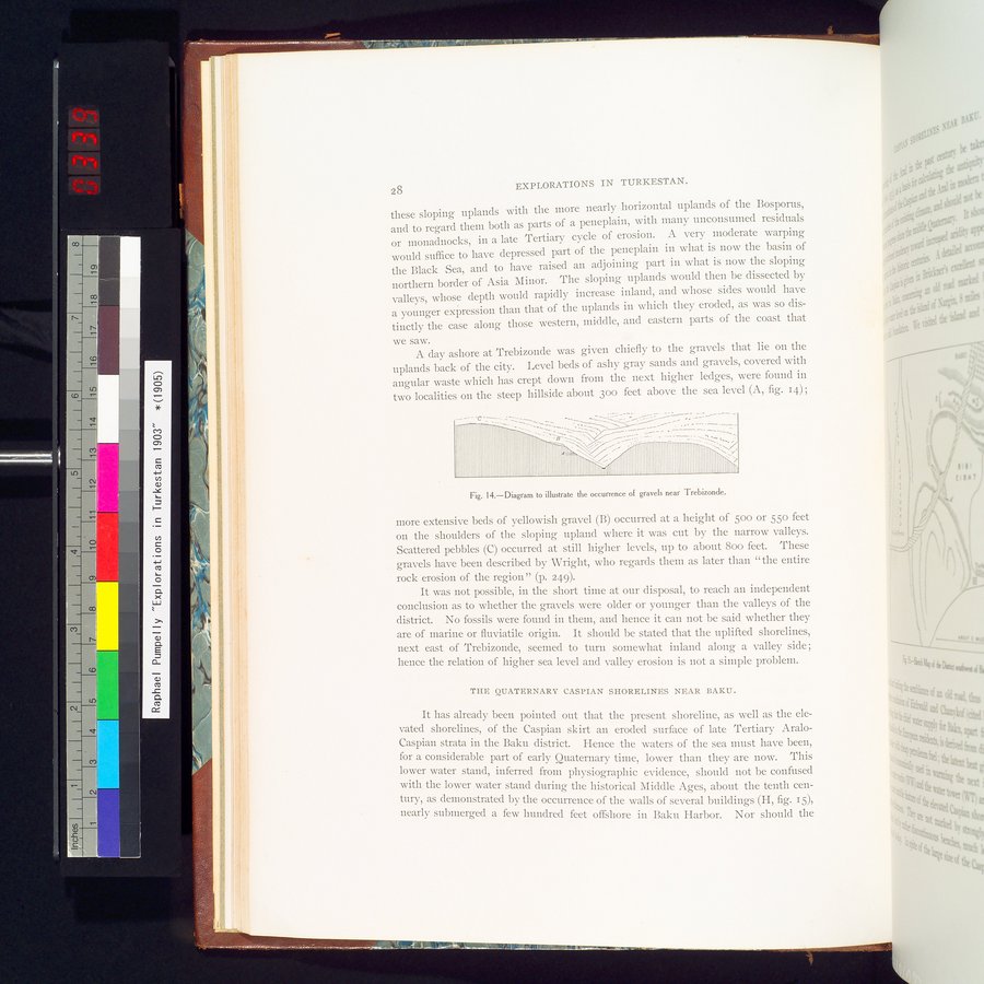 |
| Diagram to illustrate the occurrence of gravels near Trebizonde. |
EXPLORATIONS IN TURKESTAN.
these sloping uplands with the more nearly horizontal uplands of the Bosporus, and to regard them both as parts of a peneplain, with many unconsumed residuals or monadnocks, in a late Tertiary cycle of erosion. A very moderate warping would suffice to have depressed part of the peneplain in what is now the basin of the Black Sea, and to have raised an adjoining part in what is now the sloping northern border of Asia Minor. The sloping uplands would then be dissected by valleys, whose depth would rapidly increase inland, and whose sides would have a younger expression than that of the uplands in which they eroded, as was so distinctly the case along those western, middle, and eastern parts of the coast that
we saw.
A day ashore at Trebizonde was given chiefly to the gravels that lie on the uplands back of the city. Level beds of ashy gray sands and gravels, covered with angular waste which has crept down from the next higher ledges, were found in two localities on the steep hillside about 300 feet above the sea level (A, fig. 14) ;
Fig. 14.—Diagram to illustrate the occurrence of gravels near Trebizonde.
more extensive beds of yellowish gravel (B) occurred at a height of 500 or 55o feet on the shoulders of the sloping upland where it was cut by the narrow valleys. Scattered pebbles (C) occurred at still higher levels, up to about Boo feet. These gravels have been described by Wright, who regards them as later than "the entire rock erosion of the region" (p. 249).
It was not possible, in the short time at our disposal, to reach an independent conclusion as to whether the gravels were older or younger than the valleys of the district. No fossils were found in them, and hence it can not be said whether they are of marine or fluviatile origin. It should be stated that the uplifted shorelines, next east of Trebizonde, seemed to turn somewhat inland along a valley side; hence the relation of higher sea level and valley erosion is not a simple problem.
THE QUATERNARY CASPIAN SHORELINES NEAR BAKU.
It has already been pointed out that the present shoreline, as well as the elevated shorelines, of the Caspian skirt an eroded surface of late Tertiary Aralo-Caspian strata in the Baku district. Hence the waters of the sea must have been, for a considerable part of early Quaternary time, lower than they are now. This lower water stand, inferred from physiographic evidence, should not be confused with the lower water stand during the historical Middle Ages, about the tenth century, as demonstrated by the occurrence of the walls of several buildings (H, fig. 15), nearly submerged a few hundred feet offshore in Baku Harbor. Nor should the
g: ~ÿ~:~'
.,`.
Y
Iln111141.1111111hIlli
– -c
28
|
Copyright (C) 2003-2019 National Institute of Informatics and The Toyo Bunko. All Rights Reserved.