National Institute of Informatics - Digital Silk Road Project
| |||||||||
|
| Explorations in Turkestan 1903 : vol.1 |
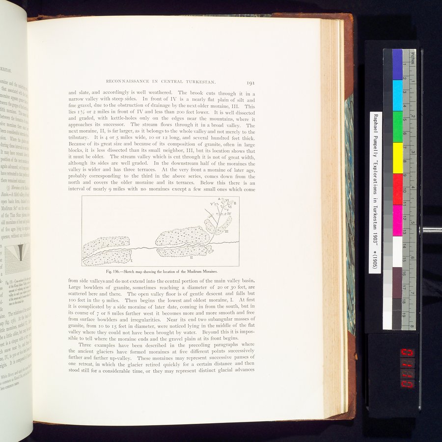 |
| Sketch map showing the location of the Mudirum Moraines. |
RECONNAISSANCE IN CENTRAL TURKESTAN. 191
and slate, and accordingly is well weathered. The brook cuts through it in a narrow valley with steep sides. In front of IV is a nearly flat plain of silt and fine gravel, due to the obstruction of drainage by the next older moraine, III. This lies I r3 or 2 miles in front of IV and less than zoo feet lower. It is well dissected and graded, with kettle-holes only on the edges near the mountains, where it approaches its successor. The stream flows through it in a broad valley. The next moraine, II, is far larger, as it belongs to the whole valley and not merely to the tributary. It is 4 or 5 miles wide, io or Iz long, and several hundred feet thick. Because of its great size and because of its composition of granite, often in large blocks, it is less dissected than its small neighbor, III, but its location shows that it must be older. The stream valley which is cut through it is not of great width, although its sides are well graded. In the downstream half of the moraines the valley is wider and has three terraces. At the very front a moraine of later age, probably corresponding to the third in the above series, comes down from the north and covers the older moraine and its terraces. Below this there is an interval of nearly 9 miles with no moraines except a few small ones which come
Fig. I36.—Sketch map showing the location of the Mudirum Moraines.
from side valleys and do not extend into the central portion of the main valley basin. Large bowlders of granite, sometimes reaching a diameter of zo or 3o feet, are scattered here and there. The open valley floor is of gentle descent and falls but Ioo feet in the 9 miles. Then begins the lowest and oldest moraine, I. At first it is complicated by a side moraine of later date, coming in from the south, but in its course of 7 or 8 miles farther west it becomes more and more smooth and free from surface bowlders and irregularities. Near its end two subangular masses of granite, from io to 15 feet in diameter, were noticed lying in the middle of the flat valley where they could not have been brought by water. Beyond this it is impossible to tell where the moraine ends and the gravel plain at its front begins.
Three examples have been described in the preceding paragraphs where the ancient glaciers have formed moraines at five different points successively farther and farther up-valley. These moraines may represent successive pauses of one retreat, in which the glacier retired quickly for a certain distance and then stood still for a considerable time, or they may represent distinct glacial advances
|
Copyright (C) 2003-2019 National Institute of Informatics and The Toyo Bunko. All Rights Reserved.