National Institute of Informatics - Digital Silk Road Project
| |||||||||
|
| Explorations in Turkestan 1903 : vol.1 |
 |
| Scheme of Terrace Development. |
TERRACED VALLEYS. 53
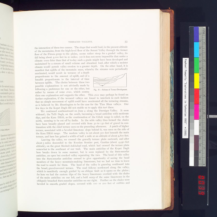
the interaction of these two causes. The slope that would lead, in the present altitude of the mountains, from the high-level floor of the Serani Valley through the former
floor of the Firuza gorge to the plains, seems rather steep for a graded valley, its
fall being about 4,000 feet in 20 miles ; yet it does not seem impossible that under a climate even drier than that of to-day such a grade might have been developed and
maintained by a stream of small volume and abundant load, after which a moister climate would pennit valley erosion to a greater depth. On the other hand, it is manifest that uplifts of the mountain mass, whereby the streams were periodically
accelerated, would result in terraces of a depth
proportionate to the amount of uplift, and of a
breadth proportionate to the interval of time
between uplifts. The choice between these two - - -
possible explanations is not advisedly made by following a preference for one or the other, but rather by means of some crux, which contra
dicts one explanation and supports the other. This crux may perhaps be found on further exploration, if the terraced valleys are found to interlock in such fashion that no simple movement of uplift could have accelerated all the terracing streams, as is believed by Mr. Huntington to be the case for the Tian Shan valleys. Our few days in the Kopet Dagh did not enable us to apply this test there.
We continued southeastward on June 4 along the Duruigar Valley. It soon widened ; the Telli Dagh, on the south, becoming a broad anticline with moderate dips, and the Kara Ilikhi, as the continuation of the Giluli range is called, on the north, seeming to be cut off by faults. In the wide valley thus formed the shales have been broadly planed and covered with from 5o to i 50 feet of gravel in continuation with the chief terrace seen on the preceding afternoon. A patch of higher terrace, associated with a beveled limestone slope behind it, was seen on the side of the Kara Ilikhi range. The modern valley is cut about 300 feet beneath the main terrace, and here has gained a width of half a mile at an altitude of about 4,800 feet.
Leaving the valley, we crossed the gravelly terrace plain eastward, and after about 3 miles descended to the Russian frontier post, Gaudan (about 4,44o feet altitude), on the great Meshed-Askhabad road, which had crossed the terrace plain somewhat to the southeast of our trail. The main anticline of the Kopet Dagh here breaks down in some manner, but is soon replaced by the Suru-muzdar anticline, an open but crooked valley separating the two. The bend of this valley into the Suru-muzdar anticline seemed to give opportunity of seeing the basal members of the heavy mountain-making limestones, but we had no time to leave the road to search for them. The head of the valley is gnawing southward into the broad, gravel-covered terrace. The road follows northward along the valley, which is manifestly enough guided by an oblique fault as it opens on the plains ; for here we had the eastern dips of the heavy limestones overlaid with the shales of the main anticline on our left, and a bold scarp of the same limestones in the obliquely breached Suru-muzdar anticline on our right. Farther on the shales were beveled in smooth, graded slopes, covered with zoo or zoo feet of cobbles and
Fig. 31.—Scheme of Terrace Development.
|
Copyright (C) 2003-2019 National Institute of Informatics and The Toyo Bunko. All Rights Reserved.