National Institute of Informatics - Digital Silk Road Project
| |||||||||
|
| Explorations in Turkestan 1903 : vol.1 |
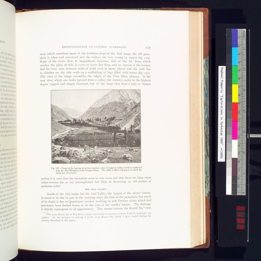 |
| Gorge of the Ispairan in its lower portion, where it begins to widen as it flows northward from the Alai Mountains to the Fergana Basin. The valley is filled with gravel, in which the stream has cut terraces. |
RECONNAISSANCE IN CENTRAL TURKESTAN. 179
areas which constitute most of the northern slope of the Alai range the old pene-plain is often well preserved and the valleys are very young in aspect (fig. 129). Some of the rivers flow in magnificent canyons ; that of the Ak Bura, which reaches the plain at Osh, is i,000 to 2,000 feet deep, and so narrow at the bottom that the river runs between walls of solid rock in many places and the trail has to clamber on the side walls on a scaffolding of logs filled with stones (fig. 13o). The crest of the range resembles, the ridges of the Tian Shan plateau. In the near view, where one looks upward from a valley, the country seems in the highest degree rugged and deeply dissected, but in the large view from a lofty or distant
Fig. 129.—Gorge of the Ispairan in its lower portion, where it begins to widen as it flows northward from the Alai Mountains to the Fergana Basin. The valley is filled with gravel, in which the stream has cut terraces.
station it is seen that the mountain crest is very even and that there are large areas where erosion has as yet accomplished but little in dissecting an old surface of moderate relief.
THE ALAI VALLEY.
South of the Alai range lies the Alai Valley, the largest of the minor basins. It seems to be due in part to the warping since the time of the peneplain, but much of its depth is due to Quaternary erosion working on soft Tertiary strata which had previously been faulted down, as in the case of the smaller basins. The drainage is strictly consequent to all appearances. The master stream, the Kuzzil Su,* runs
*The name Kuzzil Su or Red River recurs continually :incountries where Turkish languages are spoken. At the moment of writing, I recall seven Kuzzil Sus which I have visited during the journey described in this paper.
|
Copyright (C) 2003-2019 National Institute of Informatics and The Toyo Bunko. All Rights Reserved.