National Institute of Informatics - Digital Silk Road Project
| |||||||||
|
| Explorations in Turkestan 1903 : vol.1 |
 |
| Rough sketch Map and Sections of the District about Krasnovodsk. |
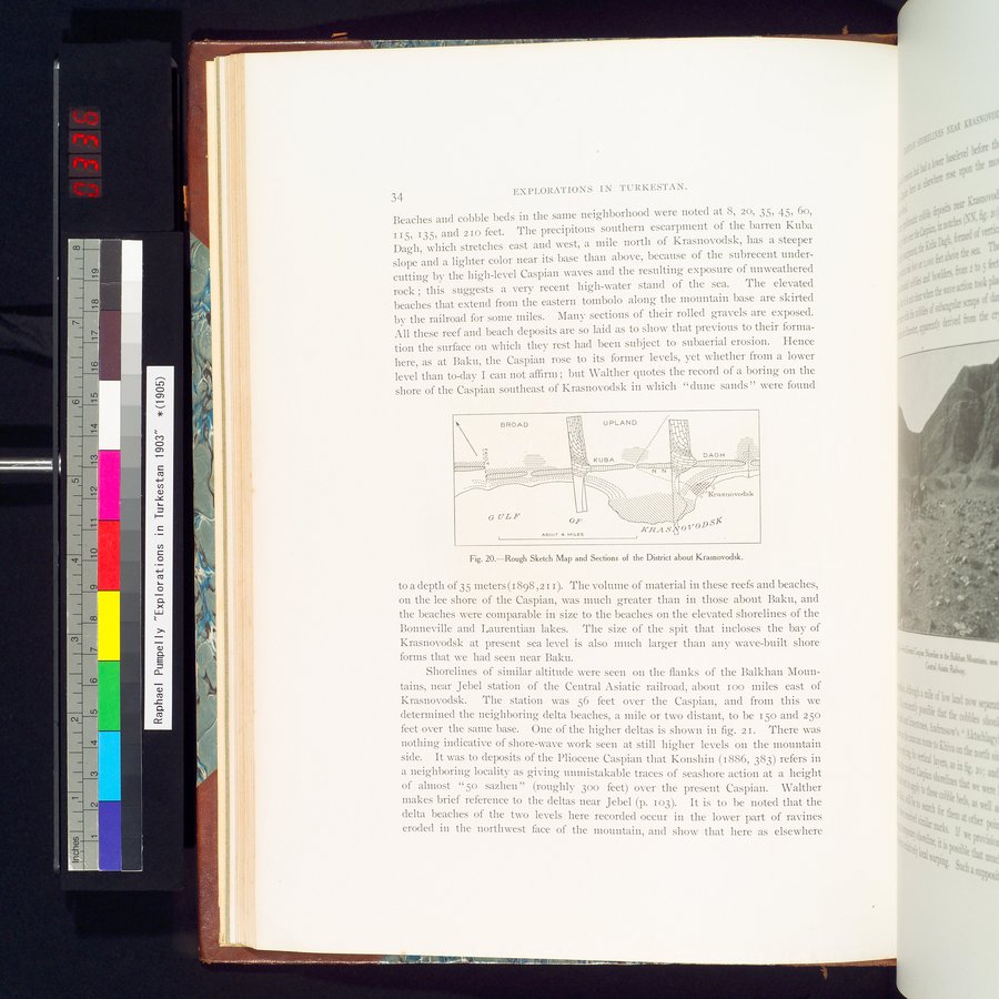
34 EXPLORATIONS IN TURKESTAN.
Beaches and cobble beds in the saine neighborhood were noted at 8, 20, 35, 45, 6o, 115, 135, and 210 feet. The precipitous southern escarpment of the barren Kuba Dagh, which stretches east and west, a mile north of Krasnovodsk, has a steeper slope and a lighter color near its base than above, because of the subrecent undercutting by the high-level Caspian waves and the resulting exposure of unweathered rock ; this suggests a very recent high-water stand of the sea. The elevated beaches that extend from the eastern tombolo along the mountain base are skirted by the railroad for some miles. Many sections of their rolled gravels are exposed. All these reef and beach deposits are so laid as to show that previous to their formation the surface on which they rest had been subject to subaerial erosion. Hence here, as at Baku, the Caspian rose to its former levels, yet whether from a lower level than to-day I can not affirm ; but Walther quotes the record of a boring on the shore of the Caspian southeast of Krasnovodsk in which "dune sands" were found
Fig. 20.—Rough Sketch Map and Sections of the District about Krasnovodsk.
to a depth of 35 meters (1898 The volume of material in these reefs and beaches,
on the lee shore of the Caspian, was much greater than in those about Baku, and the beaches were comparable in size to the beaches on the elevated shorelines of the Bonneville and Laurentian lakes. The size of the spit that incloses the bay of Krasnovodsk at present sea level is also much larger than any wave-built shore forms that we had seen near Baku.
Shorelines of similar altitude were seen on the flanks of the Balkhan Mountains, near Jebel station of the Central Asiatic railroad, about ioo miles east of Krasnovodsk. The station was 56 feet over the Caspian, and from this we determined the neighboring delta beaches, a mile or two distant, to be 150 and 25o feet over the same base. One of the higher deltas is shown in fig. 21. There was nothing indicative of shore-wave work seen at still higher levels on the mountain side. It was to deposits of the Pliocene Caspian that Konshin (1886, 383) refers in a neighboring locality as giving unmistakable traces of seashore action at a height of almost "50 sazhen " (roughly 300 feet) over the present Caspian. Walther makes brief reference to the deltas near Jebel (p. 103). It is to be noted that the delta beaches of the two levels here recorded occur in the lower part of ravines eroded in the northwest face of the mountain, and show that here as elsewhere
BROAD Ì'~lj1l\ UPLAND !•I~'I~1~~
I 1~111~1j
KUBA
~ `~;, Illllllllllllllllllnn
i nollumw
Illlllllllllllllll1i/ÌIIIIIIIillillllllll~1 :• II11111~~ ' ' ~ _
.___ •'- - ""'-' N ~ ~~!'
111111111111111111u
GULF oP `
A6OVT L MILES
Krasnovodsk
K14A S
v
|
Copyright (C) 2003-2019 National Institute of Informatics and The Toyo Bunko. All Rights Reserved.