National Institute of Informatics - Digital Silk Road Project
| |||||||||
|
| Explorations in Turkestan 1903 : vol.1 |
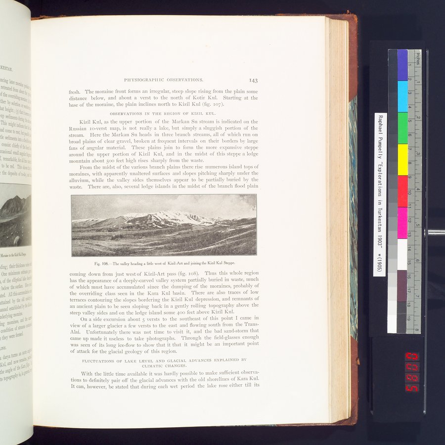 |
| The valley heading a little west of Kizil-Art and joining the Kizil Kul Steppe. |
PHYSIOGRAPHIC OBSERVATIONS. 143
fresh. The moraine front forms an irregular, steep slope rising from the plain some distance below, and about a verst to the north of Kotir Kul. Starting at the base of the moraine, the plain inclines north to Kizil Kul (fig. 107).
OBSERVATIONS IN THE REGION OR KIZIL KUL.
Kizil Kul, as the upper portion of the Markan Su stream is indicated on the Russian io-verst map, is not really a lake, but simply a sluggish portion of the stream. Here the Markan Su heads in three branch streams, all of which run on broad plains of clear gravel, broken at frequent intervals on their borders by large fans of angular material. These plains join to form the more expansive steppe around the upper portion of Kizil Kul, and in the midst of this steppe a ledge mountain about 500 feet high rises sharply from the waste.
From the midst of the various branch plains there rise numerous island tops of moraines, with apparently unaltered surfaces and slopes pitching sharply under the alluvium, while the valley sides themselves appear to be partially buried by the waste. There are, also, several ledge islands in the midst of the branch flood plain
Fig. 108.—The valley heading a little west of Kizil-Art and joining the Kizil Kul Steppe.
coming down from just west of Kizil-Art pass (fig. Io8). Thus this whole region has the appearance of a deeply-carved valley system partially buried in waste, much of which must have accumulated since the dumping of the moraines, probably of the overriding class seen in the Kara Kul basin. There are also traces of low terraces contouring the slopes bordering the Kizil Kul depression, and remnants of an ancient plain to be seen sloping back in a gently rolling topography above the steep valley sides and on the ledge island some 400 feet above Kizil Kul.
On a side excursion about 5 versts to the southeast of this point I came in view of a larger glacier a few versts to the east and flowing south from the Trans-Alai. Unfortunately there was not time to visit it, and the bad sand-storm that came up made it useless to take photographs. Through the field-glasses enough was seen of its long ice-flow to show that it that it might be an important point of attack for the glacial geology of this region.
FLUCTUATIONS OF LAKE LEVEL AND GLACIAL ADVANCES EXPLAINED BY
CLIMATIC CHANGES.
With the little time available it was hardly possible to make sufficient observations to definitely pair off the glacial advances with the old shorelines of Kara Kul. It can, however, be stated that during each wet period the lake rose either till its
|
Copyright (C) 2003-2019 National Institute of Informatics and The Toyo Bunko. All Rights Reserved.