National Institute of Informatics - Digital Silk Road Project
| |||||||||
|
| Explorations in Turkestan 1903 : vol.1 |
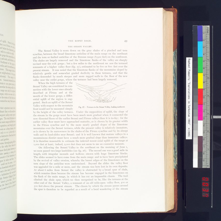 |
| Terraces in the Serani Valley, looking northwest. |
| TIIE KOPET DAGH. | 49 |
THE SERANI VALLEY.
The Serani Valley is worn down on the gray shales of a pinched and torn syncline, between the broad limestone anticline of the main range on the northeast and the torn or faulted anticline of the Buuzan range (8,922 feet) on the southwest. The shales are largely removed and the limestone flanks of the valley are sharply ravined near the exit gorge ; but a few miles to the northwest we saw the terraced remnants of a higher valley floor (fig. 27), estimated to be 600 or 800 feet over the present stream. It was noted that the limestone flanks of the mountains sloped by relatively gentle and somewhat graded declivity to these terraces, and that the flanks descended by much steeper and more ragged walls to the floor of the new valley near the outlet gorge, where the terraces had been largely removed.
When the high terraces of the •~
Serani Valley are considered in con-
mouth of the lower gorge, a differential uplift of the region is suggested. Such an uplift of the Serani Valley with respect to the mountain
Fig. 27.—Terraces in the Serani Valley, looking northwest.
front would not be measured simply
by the height of the valley terraces. Under the supposition of uplift, the slope of the stream in the gorge must have been mach more gradual when it connected the now dissected floors of the earlier Serani and Firuza valleys than it is to-day ; for the earlier valley floor must have approached maturity, as is shown by its greater width in the Firuza syncline and by the more nearly graded slopes of the limestone mountains over the Serani terraces, while the present valley is relatively immature, as is shown by its narrowness in the shales of the Firuza syncline and by its abrupt walls and its land-slides near Serani ; and it is well known that mature valleys in a mountainous district must have a much more gradual slope than immature valleys. It is therefore reasonable to estimate the inferred recent axial uplift of the range at I,000 feet at least; indeed, 2,000 feet does not seem to me an excessive measure.
On following the Serani Valley to the southeast on the morning of June r, we soon passed two large landslides (see fig. 26). The second one was a good mile in length, with irregular mounds and hollows strewn with huge limestone blocks. The slides seemed to have come from the main range and to have been precipitated by the revival of valley erosion, whereby the basset edges of the limestones on the torn slope of the anticline were undermined. Beyond the slides the valley floor was aggraded for a mile or more, and the stream was here lost in its own deposits. At about 6 miles from Serani the valley is obstructed by a broad spur of shale, which remains there because the stream has become engaged in the limestones on the flank of the main range, in which it has cut an impassable chasm. The trail climbed the shale spur, which we then recognized to be, like the terraces at the other end of the Serani Valley, a remnant of an old wide-open valley floor, 400 or 500 feet above the present stream. The chasm by which the stream passes around the spur is therefore to be regarded as a result of a local wandering of the stream
nection with the lower ones already
Y —~
described at Firuza and at the
•
|
Copyright (C) 2003-2019 National Institute of Informatics and The Toyo Bunko. All Rights Reserved.