National Institute of Informatics - Digital Silk Road Project
| |||||||||
|
| Explorations in Turkestan 1903 : vol.1 |
 |
| Shor Kul, looking south. |
RECONNAISSANCE IN CENTRAL TURKESTAN.
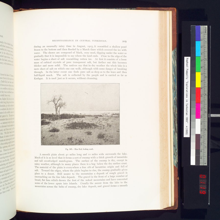
during an unusually rainy time in August, 1903, it resembled a shallow pond frozen to the bottom and then flooded by a March thaw which covered the ice with water. The shores are composed of black, oozy mud, dipping under the water so gradually that it is impossible to say where the land ends. Close to the edge of the water begins a sheet of salt resembling rotten ice. At first it consists of a loose mass of cubical crystals of pure transparent salt, but farther out this becomes thicker and more solid. The natives say that in dry weather the whole lake is a mere sheet of salt on which one can walk, although with some danger of breaking through. In the latter event one finds pure salt as deep as to the knee and then half-liquid muck. The salt is collected by the people and is carried as far as Kashgar. It is used just as it occurs, without cleansing.
Fig. 145.—Shor Kul, looking south.
A smooth plain about 40 miles long and io miles wide surrounds the lake. Much of it is so level that it forms a sort of swamp with a thick growth of tamarisks and tall sword-edged marsh-grass. The surface of the swamp is dry, except in rainy weather, although in many places there is a bog below the dry surface crust. The material of the plain is everywhere a fine silt of lacustrine origin and full of salt. Toward the edges, where the plain begins to rise, the swamp gradually gives place to a desert. Still nearer to the mountains a deposit of rough gravel is encroaching on the fine lake deposit. The gravel is the front of a large number of broad, flat fans which drown the foot of the naked mountains and have converted some of the lower spurs into islands. Usually the ascent from the lake to the mountains across the belts of swamp, dry lake deposit, and gravel forms a smooth
209
|
Copyright (C) 2003-2019 National Institute of Informatics and The Toyo Bunko. All Rights Reserved.