National Institute of Informatics - Digital Silk Road Project
| |||||||||
|
| Explorations in Turkestan 1903 : vol.1 |
 |
| Two-mile profile Terraces at Namali, looking east. | |
| Two-mile section of Synclinal Valley, southeast of Namali. |
EXCURSION INTO PERSIA. 51
range by headwaters of the Atrek which finds its way westward through the mountains to the southern Caspian. On account of the lower level of the Persian than of the Turkestan drainage system at this point, one of the headwaters of the Atrek system is actively gnawing its way through the escarpment at the lowest part of the divide into the Chibin upland and capturing drainage from the headwaters of the Serani Valley.
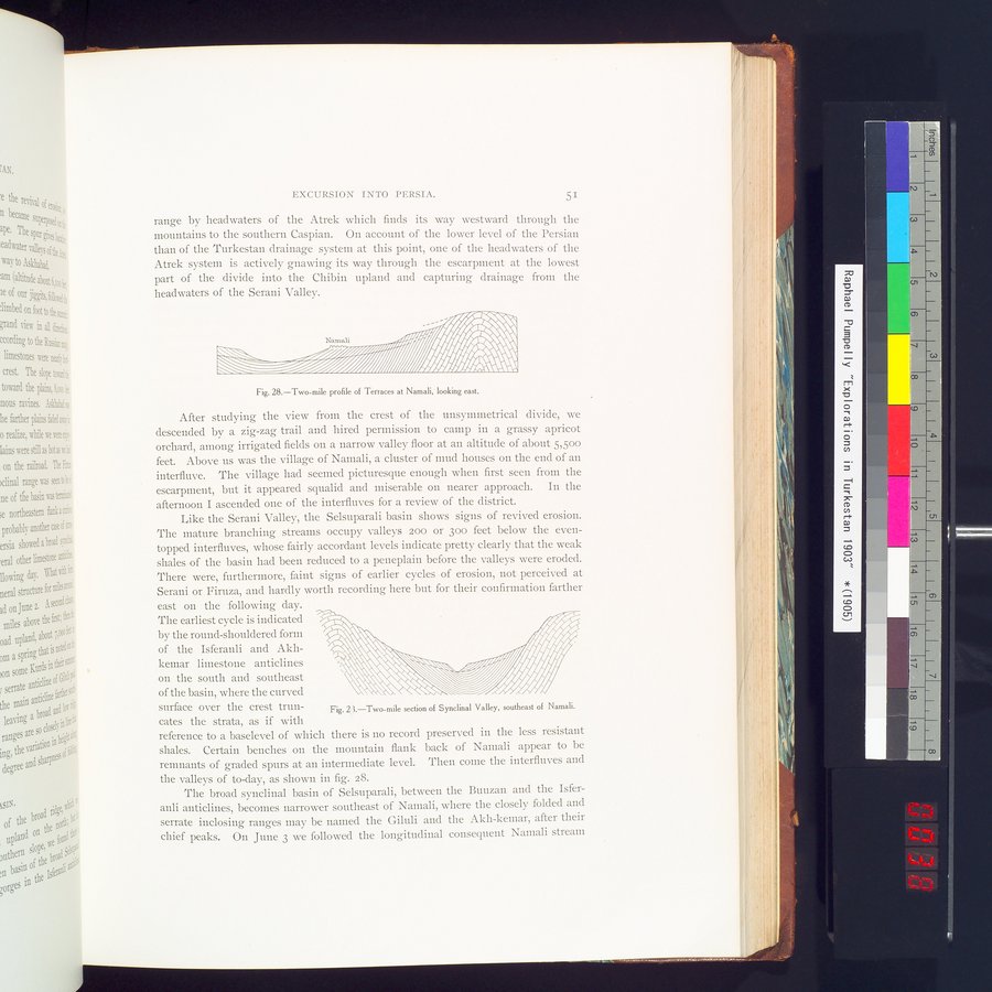
Fig. 28.—Two-mile profile of Terraces at Namali, looking east.
After studying the view from the crest of the unsymmetrical divide, we descended by a zig-zag trail and hired permission to camp in a grassy apricot orchard, among irrigated fields on a narrow valley floor at an altitude of about 5,50o feet. Above us was the village of Namali, a cluster of mud houses on the end of an interfluve. The village had seemed picturesque enough when first seen from the escarpment, but it appeared squalid and miserable on nearer approach. In the afternoon I ascended one of the interfluves for a review of the district.
Like the Serani Valley, the Selsuparali basin shows signs of revived erosion. The mature branching streams occupy valleys 200 or 30o feet below the even-topped interfluves, whose fairly accordant levels indicate pretty clearly that the weak shales of the basin had been reduced to a peneplain before the valleys were eroded. There were, furthermore, faint signs of earlier cycles of erosion, not perceived at Serani or Firuza, and hardly worth recording here but for their confirmation farther
east on the following day. The earliest cycle is indicated by the round-shouldered form of the Isferanli and Akhkeinar limestone anticlines on the south and southeast of the basin, where the curved
surface over the crest trun- Fig. 2 ì.—Two-mile section of Synclinal Valley, southeast of Namali.
cates the strata, as if with
reference to a baselevel of which there is no record preserved in the less resistant shales. Certain benches on the mountain flank back of Namali appear to be remnants of graded spurs at an intermediate level. Then come the interfluves and the valleys of to-day, as shown in fig. 28.
The broad synclinal basin of Selsuparali, between the Buuzan and the Isferanli anticlines, becomes narrower southeast of Namali, where the closely folded and serrate inclosing ranges may be named the Giluli and the Akh-kemar, after their chief peaks. On June 3 we followed the longitudinal consequent Namali stream
|
Copyright (C) 2003-2019 National Institute of Informatics and The Toyo Bunko. All Rights Reserved.