National Institute of Informatics - Digital Silk Road Project
| |||||||||
|
| Explorations in Turkestan 1903 : vol.1 |
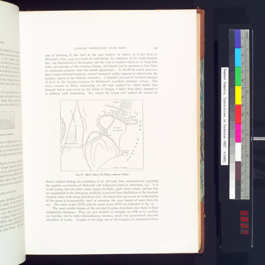 |
| Sketch Map of te District southwest of Baku. |
CASPIAN SHORELINES NEAR BAKU. 29
rate of lowering of the Aral in the past century be taken, as it has been by Obruchef (189o, 2S3), as a basis for calculating the antiquity of the Aralo-Caspian Sea ; the fluctuations of the Caspian and the Aral in modern times, or of Great Salt Lake, are episodes of the existing climate, and should not be assumed to have been in continuous progress since the middle Quaternary. It should be noted, however, that a long-continued tendency toward increased aridity appears to characterize the Caspian region in the historic centuries. A detailed account of recorded changes of level in the Caspian is given in Brückner's excellent summary (1890). The story, current in Baku, concerning an old road marked by wheel tracks that descend below water level on the island of Nargin, 8 miles from Baku, appears to be without valid foundation. We visited the `island and walked all around its
Fig. 15.—Sketch Map of the District southwest of Baku.
shores without finding the semblance of an old road, thus unconsciously repeating the negative conclusion of Eichwald and Chanykof (cited by Bruckner, 64). It is worth noting that the chief water supply for Baku, apart from certain springs that are unpalatable to the European residents, is derived from distillation of the brackish Caspian water ,with cheap petroleum fuel ; the latent heat given out in condensation of the steam is economically used in warming the next intake of water from the sea. The water works (WW) and the water tower (WT) are indicated in fig. 15.
The most notable feature of the elevated Caspian shorelines near Baku is their comparative faintness. They are not marked by strongly cut cliffs or by continuous benches, but by rather discontinuous benches, much less pronounced than the shorelines of to-day. In spite of the large size of the Caspian, its abandoned shore-
=
BAKU ~~:~:+~:•
_ l/,rll!!1//~,N!///~~/~~ / '••
7- ~ 1- S ÿ' nattGghq~ ~~//~7~~~/
~ ~ ~ .:3,,.\\i~J~~/,IIA~U~~~ vW,ó• //j :o:~ /lll~s \\\\~~~YJ~i~~~~~~i%/J//JJJ'~//~/ IYllln~ / ~w.W~///Q% =`J~ y//// ////~~~li~~A111:~ ) ~ _~// '"t",nt\\`~ "au„\~~i<~~•. Çi.~/////fli////111~1\\ i°"â; ~: ~~,ipll t~uatvm\\
r Q ~ 's ~_ %/ /~
~12---:- J =`_? `ï'y/~G/// BIBI
~
Q ~ ~ %//'•\ ~
z~ 1 Q ~ `\~~\\\\\1111///~rl// ///i/~i E 1 B A T
//,'i~ /
j
~Vble`hi-Vbrota ~ ~ "'w, ': %/ ~+
~ . / 7 . / ~ ~ : s ~j'
\\~~~~a►~`\r~~~■_~~~ _ ~
3 ~ 3u~ i
3 = ~ Turkish i
. ~ ~ _ ~ = _ = ~}Village
S* i ~ LR
i / '
a !
; G
ABOUT 3 MILES
|
Copyright (C) 2003-2019 National Institute of Informatics and The Toyo Bunko. All Rights Reserved.