National Institute of Informatics - Digital Silk Road Project
| |||||||||
|
| Explorations in Turkestan 1903 : vol.1 |
 |
| Terraces of the (western) Kugart, looking northeast. |
EXPLORATIONS IN TURKESTAN.
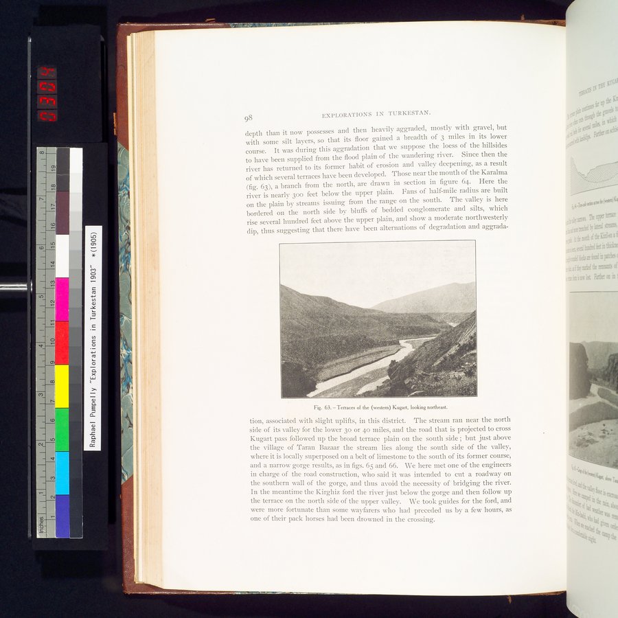
depth than it now possesses and then heavily aggraded, mostly with gravel, but with some silt layers, so that its floor gained a breadth of 3 miles in its lower course. It was during this aggradation that we suppose the loess of the hillsides to have been supplied from the flood plain of the wandering river. Since then the river has returned to its former habit of erosion and valley deepening, as a result of which several terraces have been developed. Those near the mouth of the Karalma (fig. 63), a branch from the north, are drawn in section in figure 64. Here the river is nearly 30o feet below the upper plain. Fans of half-mile radius are built on the plain by streams issuing from the range on the south. The valley is here bordered on the north side by bluffs of bedded conglomerate and silts, which rise several hundred feet above the upper plain, and show a moderate northwesterly dip, thus suggesting that there have been alternations of degradation and aggrada-
Fig. 63. — Terraces of the (western) Kugart, looking northeast.
tion, associated with slight uplifts, in this district. The stream ran near the north side of its valley for the lower 3o or 4o miles, and the road that is projected to cross Kugart pass followed up the broad terrace plain on the south side ; but just above the village of Taran Bazaar the stream lies along the south side of the valley, where it is locally superposed on a belt of limestone to the south of its former course, and a narrow gorge results, as in figs. 65 and 66. We here met one of the engineers in charge of the road construction, who said it was intended to cut a roadway on the southern wall of the gorge, and thus avoid the necessity of bridging the river. In the meantime the Kirghiz ford the river just below the gorge and then follow up the terrace on the north side of the upper valley. We took guides for the ford, and were more fortunate than some wayfarers who had preceded us by a few hours, as one of their pack horses had been drowned in the crossing.
98
|
Copyright (C) 2003-2019 National Institute of Informatics and The Toyo Bunko. All Rights Reserved.