National Institute of Informatics - Digital Silk Road Project
| |||||||||
|
| Explorations in Turkestan 1903 : vol.1 |
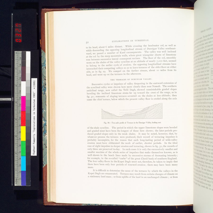 |
| Two-mile profile of Terraces in the Duruigar Valley, looking east. |
EXPLORATIONS IN TURKESTAN.
52
to its head, about 6 miles distant. While crossing the headwater col, as well as while descending the opposing longitudinal stream of Duruigar Valley southeastward, we passed a number of Kurd encampments. The valley was well inclosed at the col by the steep mountain walls, where great triangular sheets of limestone rose between successive lateral consequent ravines. The floor of the col, smoothly worn on the shales of the valley syncline at an altitude of nearly 7,000 feet, seemed to belong to the earlier cycle of erosion; the opposing longitudinal streams have intrenched their competing valleys so as to leave terraces of the older floor on either side, as in fig. 29. We camped on the further stream, about Io miles from its head, and went up on the terraces in the afternoon.
THE TERRACES OR DURUIGAR VALLEY.
Successive cycles or impulses of valley deepening in the eastward extension of the synclinal valley were shown here more clearly than near Namali. The southern anticlinal range, now called the Telli Dagh, showed unmistakable graded slopes beveling the inclined limestone strata far up toward the crest of the range, as in fig. 3o ; remnants of sloping terraces occurred on the shales at less altitude ; then came the chief terrace, below which the present valley floor is eroded along the axis
~
, ~~~®~~~Ì
- -- ,í~~~~iiii-%%~~~~-~-~~~I~
;~'`w~~.,, ---=-- _ - - - /////// ~ ~~/II~I
1` ~ ~~q~~~,, ,h.,,,,...~/~O~ ~~/~/
~. \\~~~~~1111ïüi1/%~/%%%%%%///////////~~~~ ~. ~
I ~I.~ . ,. .~!.~
Fig. 30.—Two-mile profile of Terraces in the Duruigar Valley, looking east.
of the shale syncline. The period in which the upper limestone slopes were beveled and graded must have been the longest of those here shown ; the later periods produced graded slopes only in the weak shales. It may be noted, however, that, by whatever process the terraces were produced, their record of terracing impulses is probably incomplete, for the reason that each long-lasting period of wide-valley erosion must have obliterated the work of earlier, shorter periods. In the ideal case of eight impulses to deeper erosion and terracing, shown in fig. 31, the records of only three are preserved to-day. In such cases it is only the successively smaller and smaller maxima of the whole series of impulses that make themselves known, as is well shown in the beach lines made by successive storms of decreasing intensity; for example, in the so-called " curbs" of the great Chesil bank of southern England. The four valley floors in the Kopet Dagh must not, therefore, be taken to imply that there have been only four periods of renewed erosion ; there may have been many
more.
It is difficult to determine the cause of the terraces by which the valleys in the Kopet Dagh are ornamented. Terraces may result from certain changes of climate on a stationary land mass ; or from uplifts of the land in an unchanged climate ; or from
|
Copyright (C) 2003-2019 National Institute of Informatics and The Toyo Bunko. All Rights Reserved.