National Institute of Informatics - Digital Silk Road Project
| |||||||||
|
| Explorations in Turkestan 1903 : vol.1 |
 |
| Sketch map of the double basin of Iran. |
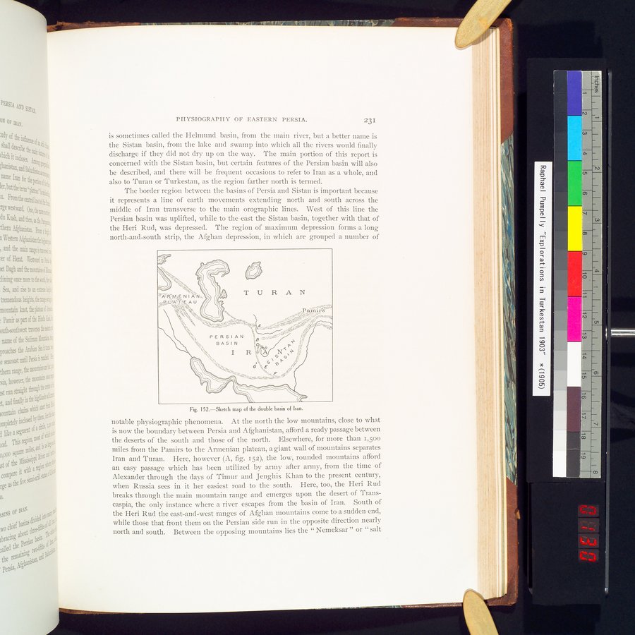
PHYSIOGRAPHY OF EASTERN PERSIA. 231
is sometimes called the Helmund basin, from the main river, but a better name is the Sistan basin, from the lake and swamp into which all the rivers would finally discharge if they did not dry up on the way. The main portion of this report is concerned with the Sistan basin, but certain features of the Persian basin will also be described, and there will be frequent occasions to refer to Iran as a whole, and also to Turan or Turkestan, as the region farther north is termed.
The border region between the basins of Persia and Sistan is important because it represents a line of earth movements extending north and south across the middle of Iran transverse to the main orographic lines. West of this line the Persian basin was uplifted, while to the east the Sistan basin, together with that of the Heri Rud, was depressed. The region of maximum depression forms a long north-and-south strip, the Afghan depression, in which are grouped a number of
Fig. 152.—Sketch map of the double basin of Iran.
notable physiographic phenomena. At the north the low mountains, close to what is now the boundary between Persia and Afghanistan, afford a ready passage between the deserts of the south and those of the north. Elsewhere, for more than 1,500 miles from the Pamirs to the Armenian plateau, a giant wall of mountains separates Iran and Turan. Here, however (A, fig. 152), the low, rounded mountains afford an easy passage which has been utilized by army after army, from the time of Alexander through the days of Timur and Jenghis Khan to the present century, when Russia sees in it her easiest road to the south. Here, too, the Heri Rud breaks through the main mountain range and emerges upon the desert of Transcaspia, the only instance where a river escapes from the basin of Iran. South of the Heri Rud the east-and-west ranges of Afghan mountains come to a sudden end, while those that front them on the Persian side run in the opposite direction nearly north and south. Between the opposing mountains lies the " Nemeksar " or " salt
|
Copyright (C) 2003-2019 National Institute of Informatics and The Toyo Bunko. All Rights Reserved.