 IIIFカラー高解像度
国立情報学研究所 - ディジタル・シルクロード・プロジェクト
| |||||||||
|
| IIIFカラー高解像度 |
| Southern Tibet : vol.7 | |
| 南チベット : vol.7 |
 |
 |
 |
 |
 |
 |
|
|
 |
|
|
|
|
|
|
|
|
引用情報
THE INFLUENCE OF HUMBOLDT.
189
Russians and Armenians pass through Cashgar to Tibet, and even lower down; but the Chinese arrest the progress of all eastward of Yarkand .... The people of Cashgar itself are composed of Turks and Uzbeks, and visitors also arrive from Tibet and Cashmeer.» I
As to the principal orographical features of the interior of Asia nearly all intelligent geographers followed HUMBOLDT as a leader. A few examples will be enough. Speaking of the »Normal Directions of the ranges» C. ZIMMERMANN says: »Herr Alex. von Humboldt hat diesen Gegenstand insbesondere behandelt und so vollständig erwiesen, dass jeder, welcher im Stande ist, den Untersuchungen zu folgen, von der allgemeinen Wahrheit des in den Grund-Lineamenten entworfenen Reliefs von Hinter-Asien überzeugt werden muss.»2
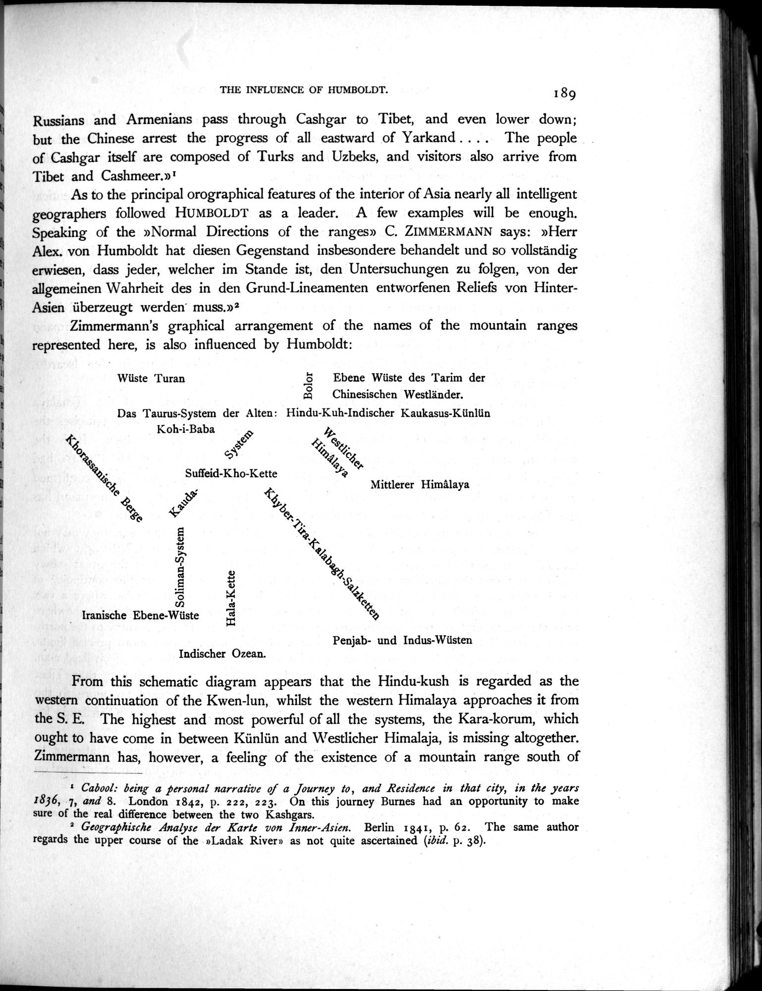
Zimmermann's graphical arrangement of the names of the mountain ranges represented here, is also influenced by Humboldt:
Wüste 'I'uran 8 Ebene Wüste des Tarim der
cD Chinesischen Westländer.
Das Taurus-System der Alten : Hindu-Kuh-Indischer Kaukasus-Künlün
Koh-i-Baba
Mittlerer Himâlaya
Suffeid-Kho-Kette
b~ ~~
(" ~
~o `t ~
~~.
~.+ cn
(;?<5
cd
o
Iranische Ebene-Wüste
Hala-Kette
Penjab- und Indus-Wüsten
Indischer Ozean.
From this schematic diagram appears that the Hindu-kush is regarded as the western continuation of the Kwen-lun, whilst the western Himalaya approaches it from the S. E. The highest and most powerful of all the systems, the Kara-korum, which ought to have come in between Künlün and Westlicher Himalaja, is missing altogether. Zimmermann has, however, a feeling of the existence of a mountain range south of
I Cabool: being a personal narrative of a Journey to, and Residence in that city, in the years 1836, 7, and 8. London 1842, p. 222; 2 23. On this journey Burnes had an opportunity to make sure of the real difference between the two Kashgars.
2 Geographische Analyse der Karte von Inner-Asien. Berlin 1841, p. 62. The same author regards the upper course of the »Ladak River» as not quite ascertained (ibid. p. 38).
|
|
|
|
|
|
|
|
|
Copyright (C) 2003-2019
National Institute of Informatics(国立情報学研究所)
and
The Toyo Bunko(東洋文庫). All Rights Reserved.
本ウェブサイトに掲載するデジタル文化資源の無断転載は固くお断りいたします。