National Institute of Informatics - Digital Silk Road Project
| |||||||||
|
| Scientific Results of a Journey in Central Asia, 1899-1902 : vol.3 |
 |
18o MY FIRST JOURNEY IN NORTH-EASTERN TIBET.
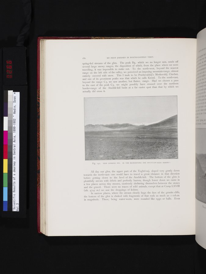
spring-fed streams of the glen. The peak B3, which we no longer saw, sends off several large snowy ranges, the disposition of which, from the place where we were travelling, it was impossible to make out. To the north-west, beyond the nearest range on the left side of the valley, we perceived an imposing mountain-range, almost entirely covered with snow. This I took to be Prschevalskij's Moskovskij Chrebet, and one of its prominent peaks was that which he calls Kreml. To the south-east, beyond the range C3, we saw another, but flatter, range. Had we chosen a pass to the east of the peak C3, we might possibly have crossed over the northern border-range of the Atschik-köl basin at a far easier spot than that by which we
actually did cross it.
All day our glen, the upper part of the Toghri-saj, sloped very gently down towards the north-east : one would have to travel a great distance in that direction before getting down to the level of the Atschik-köl. The bottom of the glen is
plentifully strewn with débris and perfectly barren, though lower down we came in a few places across tiny mosses, cautiously sheltering themselves between the stones
and the gravel. There were no traces of wild animals, except that at Camp LXVIII
(alt. 4795 m.) we saw the droppings of kulans.
In narrow places, where the stream closely hugs the face of the granite cliffs,
the bottom of the glen is choked with fragments of that rock as much as I cub.m. in magnitude. These, being water-worn, were rounded like eggs or balls. Even
Fig. I4I. VIEW LOOKING NW. IN THE BACKGROUND THE MOUNTAIN-MASS »KREML».
|
Copyright (C) 2003-2019 National Institute of Informatics and The Toyo Bunko. All Rights Reserved.