National Institute of Informatics - Digital Silk Road Project
| |||||||||
|
| Scientific Results of a Journey in Central Asia, 1899-1902 : vol.3 |
 |
566 MY JOURNEY ALONG THE ARKA—TAGH IN 1896.
At the foot of the mountains there is a flat strip of land and this increases in breadth towards the west; it is strewn with fine schistose detritus, in which two ramparts were distinguishable I to 2 m. above the then existing level of the lake. Probably this may be taken as an indication that the lake is actually shrinking. Between these two ramparts, which run faithfully parallel to the outline of the lake, there are a number of lagoons, some containing water, others dry, and all with fine sediment in their bottom. All the brooks that find their way into the lake empty themselves first into similar lagoons, and the lagoons, which are always completely separate
from the lake, are connected with it by underground emissaries. The water in the lagoons is perfectly fresh.
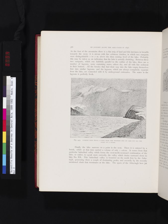
Fig. 445. LOOKING EAST FROM A POINT NEAR THE WESTERN END OF LAKE NO: XX; THE ONSET OF A STORM.
Finally the lake narrows to a point in the west. There it is entered by a brook, which at that time carried a volume of only I cub.m. It comes from that particular latitudinal valley which forms the west-north-westward continuation of the lake, or rather, to speak more correctly, the valley which drains eastward down to lake No. XX. This latitudinal valley is bounded on the north first by the Arkatagh, possessing there a couple of dominating peaks, and secondly by the recently mentioned chain that terminates at the lake. The spurs of the Arka-tagh here jut
l~le tO~
brools szji
4ttide tie 14
_
|
Copyright (C) 2003-2019 National Institute of Informatics and The Toyo Bunko. All Rights Reserved.