National Institute of Informatics - Digital Silk Road Project
| |||||||||
|
| Scientific Results of a Journey in Central Asia, 1899-1902 : vol.3 |
 |
280
JOURNEY TO ANAMBARUIN-ULA.
iï
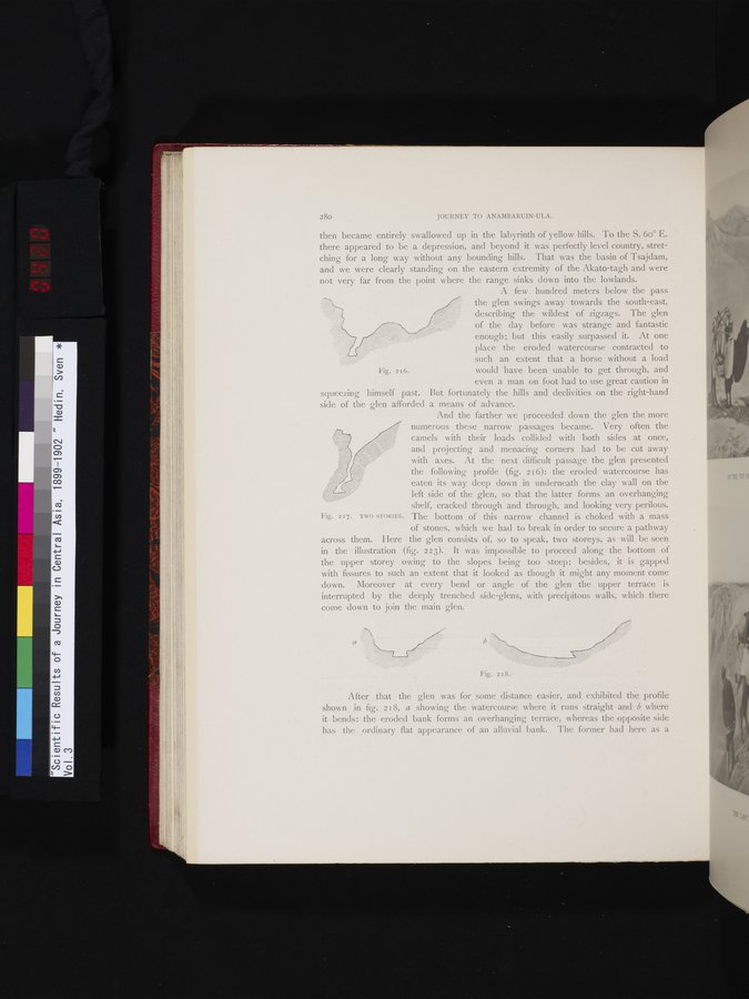
Fig. 216.
then became entirely swallowed up in the labyrinth of yellow hills. To the S. 6o° E. there appeared to be a depression, and beyond it was perfectly level country, stretching for a long way without any bounding hills. That was the basin of Tsajdam, and we were clearly standing on the eastern extremity of the Akato-tagh and were not very far from the point where the range sinks down into the lowlands.
A few hundred meters below the pass
the glen swings away towards the south-east,
%% '%% describing the wildest of zigzags. The glen
of the day before was strange and fantastic
enough; but this easily surpassed it. At one place the eroded watercourse contracted to
such an extent that a horse without a load
would have been unable to get through, and even a man on foot had to use great caution in
squeezing himself past. But fortunately the hills and declivities on the right-hand side of the glen afforded a means of advance.
And the farther we proceeded down the glen the more numerous these narrow passages became. Very often the camels with their loads collided with both sides at once, and projecting and menacing corners had to be cut away with axes. At the next difficult passage the glen presented the following profile (fig. 216): the eroded watercourse has
eaten its way deep down in underneath the clay wall on the left side of the glen, so that the latter forms an overhanging shelf, cracked through and through, and looking very perilous.
Fig. 217. TWO STORIES. The bottom of this narrow channel is choked with a mass
of stones, which we had to break in order to secure a pathway across them. Here the glen consists of, so to speak, two storeys, as will be seen in the illustration (fig. 223). It was impossible to proceed along the bottom of the upper storey owing to the slopes being too steep; besides, it is gapped with fissures to such an extent that it looked as though it might any moment come down. Moreover at every bend or angle of the glen the upper terrace is interrupted by the deeply trenched side-glens, with precipitous walls, which there come down to join the main glen.
Fig. 218.
After that the glen was for some distance easier, and exhibited the profile shown in fig. 218, a showing the watercourse where it runs straight and b where it bends: the eroded bank forms an overhanging terrace, whereas the opposite side has the ordinary flat appearance of an alluvial bank. The former had here as a
|
Copyright (C) 2003-2019 National Institute of Informatics and The Toyo Bunko. All Rights Reserved.