National Institute of Informatics - Digital Silk Road Project
| |||||||||
|
| Scientific Results of a Journey in Central Asia, 1899-1902 : vol.3 |
 |
284 JOURNEY TO ANAMBARUIN-UI,A.
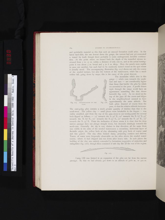
and perishable material as this that such an unusual formation could arise. In the latest land-slide, the one lowest down the gorge, the torrent had not yet excavated a tunnel for itself, though there probably is some underground, invisible continuation. At the point where we turned back the depth of the tunnelled stream increased from 2 to 15 m. within a distance of only 200 m., and at the actual turning-point it was about 3 m. broad and 4 to 6 m. deep. Here the camels were unable to pass one another, but each had to be cautiously turned round on the spot where it actually stood. The accompanying illustration (fig. 223) shows not only the course of the eroded terrace, but also the bottom of the watercourse, which has a much swifter fall, going down by steps; this is the cause of the great descent.
The mountains which shut in this gorge — which runs towards the southeast and east — are considerably higher than those that border the glen by which we ascended to the pass. A profile drawn right through the range would have an appearance something like that shown
l herewith (fig. 2 2 7). As we stood on the
top of the pass all the crests and ridges in the neighbourhood seemed to have approximately the same altitude. But both glens descend of course from the pass, so that the relative altitude increases.
The east-going glen contains a much greater quantity of detritus than that to the south-west. The yellow clay — small pieces were breakable in the fingers — was visibly stratified, and from the top of the pass down to our turning-point the several beds dipped as follows — 14° towards the S. 5o° E., 20° towards the N. 85° E.,35° towards the N. 6o° E., 75° towards the N. 55° E., 22° towards the N. 3o° E., 75° towards the N. 55° E. From the inclination of these strata it is clear that the deep narrow passage does not plunge straight down, but descends slantingly towards the north-east. Generally the dip is very distinct in that direction; all the same there was visible in the sides of the eroded watercourse a secondary, horizontal layer of fluviatile origin, the yellow beds of clay alternating with grey beds of coarse sand and fine gravel. The clay often formed sharp, projecting cornices and shelves. Traces of water were frequently observable on the sides above the eroded watercourse, where it had dripped and run down after heavy rain. In such places the bedding of the clay was entirely concealed by formations suggestive of stalactites and stalagmites (fig. 226), though these consisted of soft clay like all the rest of the region.
Fig. 225. STRATIFICATION OF THE
CLAY.
Fig. 226.
z/~~~~~~/ali//yiii~i.,".,,,,,,.. ...... mYY//~//ti~ /e~/i~~~~~~~~~~/
Fig. 227.
Camp CIII was formed in an expansion of the glen not far from the narrow passage. By that we had already got down to an altitude of 3086 m., or 400 m.
|
Copyright (C) 2003-2019 National Institute of Informatics and The Toyo Bunko. All Rights Reserved.