National Institute of Informatics - Digital Silk Road Project
| |||||||||
|
| Scientific Results of a Journey in Central Asia, 1899-1902 : vol.3 |
 |
188 DIY FIRST JOURNEY IN NORTH-EASTERN TIBET.
grass than we had seen for a long time, and japkak also was fairly abundant. Traces of fires indicated that the locality is visited by the gold-miners.
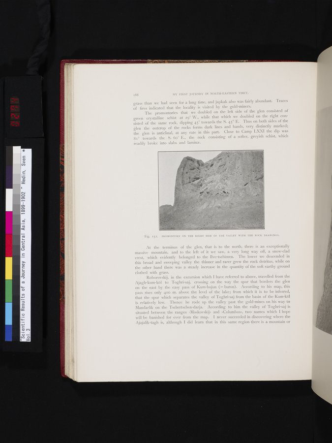
The promontories that we doubled on the left side of the glen consisted of green crystalline schist at 29° W., while that which we doubled on the right consisted of the same rock, dipping 45° towards the S. 45° E. Thus on both sides of the glen the outcrop of the rocks forms dark lines and bands, very distinctly marked; the glen is anticlinal, at any rate in this part. Close to Camp LXXI the dip, was 81° towards the S. 60° E., the rock consisting of a softer, greyish schist, which readily broke into slabs and laminae.
Fig. 152. PROMONTORY ON THE RIGHT SIDE OF THE VALLEY WITH THE ROCK DRAWINGS.
At the terminus of the glen, that is to the north, there is an exceptionally massive mountain, and to the left of it we saw, a very long way off, a snow-clad crest, which evidently belonged to the Ilve-tschimen. The lower we descended in this broad and sweeping valley the thinner and rarer grew the rock detritus, while on the other hand there was a steady increase in the quantity of the soft earthy ground clothed with grass.
Roborovskij, in the excursion which I have referred to above, travelled from the Ajagh-kum-köl to Toghri-saj, crossing on the way the spur that borders the glen on the east by the easy pass of ' Kum-bujun (= burun). According to his map, this pass rises only 400 m. above the level of the lake; from which it is to be inferred, that the spur which separates the valley of Toghri-saj from the basin of the Kum-köl is relatively low. Thence he rode up the valley past the gold-mines on his way to Mandarlik on the Tschertschen-darja. According to him the valley of Toghri-saj is situated between the ranges »Moskovskij» and »Columbus», two names which I hope will be banished for ever from the map. I never succeeded in discovering where the Ajajalik-tagh is, although I did learn that in this same region there is a mountain or
|
Copyright (C) 2003-2019 National Institute of Informatics and The Toyo Bunko. All Rights Reserved.