National Institute of Informatics - Digital Silk Road Project
| |||||||||
|
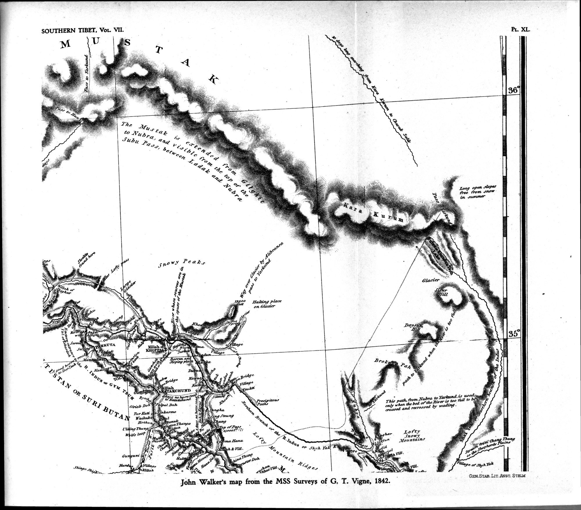
| Southern Tibet : vol.7 |
 |
,
_
11 rag e
)41fry
. ,
,
Tur Kuti k Lava
tic-fritakchvnii
:I.rarae1121/Ctiti:5\
J24
leop al41
•
Thhr path- fronz, Witbra, to litrIczind jj used,,,,m, may whea the bed ot'theRiver is too till/ t' cro.ssed ami recro.s.sed by wading .
"%_ ,
|
Copyright (C) 2003-2019 National Institute of Informatics and The Toyo Bunko. All Rights Reserved.