国立情報学研究所 - ディジタル・シルクロード・プロジェクト
| |||||||||
|
| Southern Tibet : vol.3 | |
| 南チベット : vol.3 |
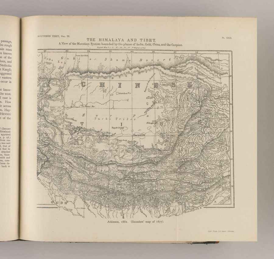 |
TILE H IM.A%AY11. AND T IB ]E T~
A View of -the N[ountaln System bounded by-the plains of India.,, Gobi, China, and the Caspian.
0 ;A f0 ..2.%ieNlif!44I IA/Feet
eve jdl!4. •,~
~ o
r\►ra
f~
.,."
~Nt
,Eldzigg~i
cJ~-
ilMbx~t
; c . ,P" h\N%•" c,•i
~`~:
"rt `"'~i~~~~.émo~'
~ o ~ >e!A% IN~
-1,404I6'
vu'w+wM1N, -no'71A . 11
a~'~w~' `~ ■`,,.rrq ~i~"~~faAUyrwu f~s~ , frr!-~.f.."~°~/tll~//r411t<1~ 1'~ » .~`~(~ ,,~ ~ • ~~ 10n~t .. Lt ~ I/ ~~I/))\hniÎJuii rfii ~ ~\~n~`l~~m'.~\ .. ~I~,
;,q;~i1~~;. ~"•~ I~~~.~
Atkinson, 1882. (Saunders' map of 1877).
l,„ 4ktv4:/q l ~' •`ti~Y~rtmy1f;~ r7iNa .
sulS l
h M.u'„ 1gi ~o~~~~/(i► rph~-cl' ~ kl.~ti~
'I,~h~l•2.~~ t,.f,i ,7,j~l~fI, $ ~fi llN ^`n" ' `..ï.~h!•ot~.'ft.. ."U,F
i 41,>i,.4
•
r '~ ~, y
i R,hlyc ,
|
Copyright (C) 2003-2019
National Institute of Informatics(国立情報学研究所)
and
The Toyo Bunko(東洋文庫). All Rights Reserved.
本ウェブサイトに掲載するデジタル文化資源の無断転載は固くお断りいたします。