国立情報学研究所 - ディジタル・シルクロード・プロジェクト
| |||||||||
|
| Scientific Results of a Journey in Central Asia, 1899-1902 : vol.3 | |
| 1899-1902年の中央アジア旅行における科学的成果 : vol.3 |
 |
FROM TOGHRI-SAJ TO TEMIRLIK: ROCK PICTURES. 193
of the Tschimen valley and then down the glen of the Tschertschen-darja, which forms the direct continuation of the valley. On the map of the Russian General Staff we find entered several of these names, as well as two or three that were not known to my informant: the map list is Don-saj (= Dung-saj), Kosuk-kakti, Karatschoka, Dimna-lik (= Dimen-alik), Basch-malghun, Mandarlik, Tschoka-davan, and Muna-bulak (= Munar-bulak).
The extreme upper end of the valley of Toghri-saj is said to be known under the name of Ajghin-otak.
From Camp LXXI a short cut leads east-north-eastwards to Temirlik across the Piaslik range, the westward continuation of the Tschimen-tagh; this route runs via Kum-bulak and Kisil-tschap. I preferred to keep to the valley of Toghri-saj until I came to the valley of Tschimen, my object being to reach good grazing as soon as possible. The brook makes its way by the east side of the little mountain-butte at Camp LXXI. We kept to the west of it, and crossing over an insignificant saddle once more went down into the valley of Toghri-saj, which again contracts to a narrow defile between vertical cliffs. Here too the Toghri-saj is a transverse valley, though not as Roborovskij says between »Moskovskij» and »Columbus» (= Kalta-alaghan), for the Kalta-alaghan does not touch the Toghri-saj at all, but, decreasing in altitude, comes to an end before that. The lower defile of the Toghri-saj pierces the Piaslik-tagh, a range identical with the Tschimen-tagh, which
Redin, ,journey in Central Asia. III. 25
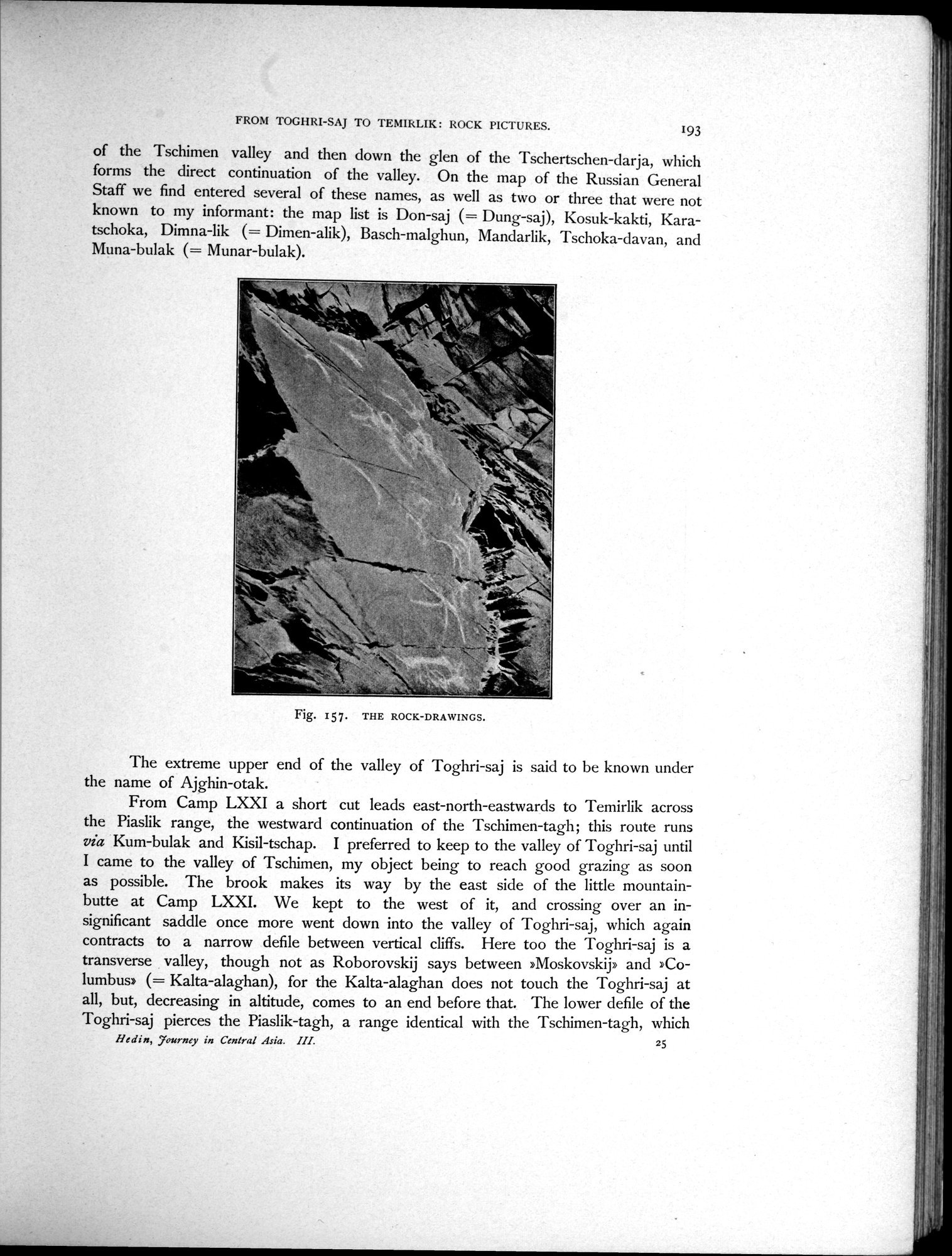
Fig. 157. THE ROCK-DRAWINGS.
|
Copyright (C) 2003-2019
National Institute of Informatics(国立情報学研究所)
and
The Toyo Bunko(東洋文庫). All Rights Reserved.
本ウェブサイトに掲載するデジタル文化資源の無断転載は固くお断りいたします。