国立情報学研究所 - ディジタル・シルクロード・プロジェクト
| |||||||||
|
| Scientific Results of a Journey in Central Asia, 1899-1902 : vol.3 | |
| 1899-1902年の中央アジア旅行における科学的成果 : vol.3 |
 |
296 JOURNEY TO ANAMBARUIN-ULA.
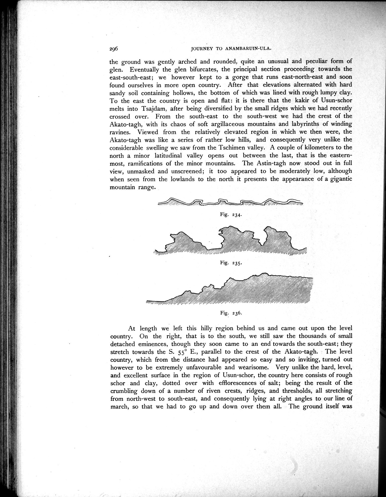
the ground was gently arched and rounded, quite an unusual and peculiar form of glen. Eventually the glen bifurcates, the principal section proceeding towards the east-south-east; we however kept to a gorge that runs east-north-east and soon found ourselves in more open country. After that elevations alternated with hard sandy soil containing hollows, the bottom of which was lined with rough lumpy clay. To the east the country is open and flat: it is there that the kakir of Usun-schor melts into Tsajdam, after being diversified by the small ridges which we had recently crossed over. From the south-east to the south-west we had the crest of the Akato-tagh, with its chaos of soft argillaceous mountains and labyrinths of winding ravines. Viewed from the relatively elevated region in which we then were, the Akato-tagh was like a series of rather low hills, and consequently very unlike the considerable swelling we saw from the Tschimen valley. A couple of kilometers to the north a minor latitudinal valley opens out between the last, that is the easternmost, ramifications of the minor mountains. The Astin-tagh now stood out in full view, unmasked and unscreened; it too appeared to be moderately low, although when seen from the lowlands to the north it presents the appearance of a gigantic mountain range.
| Fig. 234. | ||
| Fig. 235. | ||
| Fig. 236. | ||
At length we left this hilly region behind us and came out upon the level country. On the right, that is to the south, we still saw the thousands of small detached eminences, though they soon came to an end towards the south-east; they stretch towards the S. 55° E., parallel to the crest of the Akato-tagh. The level country, which from the distance had appeared so easy and so inviting, turned out however to be extremely unfavourable and wearisome. Very unlike the hard, level, and excellent surface in the region of Usun-schor, the country here consists of rough schor and clay, dotted over with efflorescences of salt; being the result of the crumbling down of a number of riven crests, ridges, and thresholds, all stretching from north-west to south-east, and consequently lying at right angles to our line of march, so that we had to go up and down over them all. The ground itself was
|
Copyright (C) 2003-2019
National Institute of Informatics(国立情報学研究所)
and
The Toyo Bunko(東洋文庫). All Rights Reserved.
本ウェブサイトに掲載するデジタル文化資源の無断転載は固くお断りいたします。