National Institute of Informatics - Digital Silk Road Project
| |||||||||
|
| Mission Scientifique dans la Haute Asie 1890-1895 : vol.3 | |
| Scientific Mission to High Asia 1890-1895 : vol.3 |
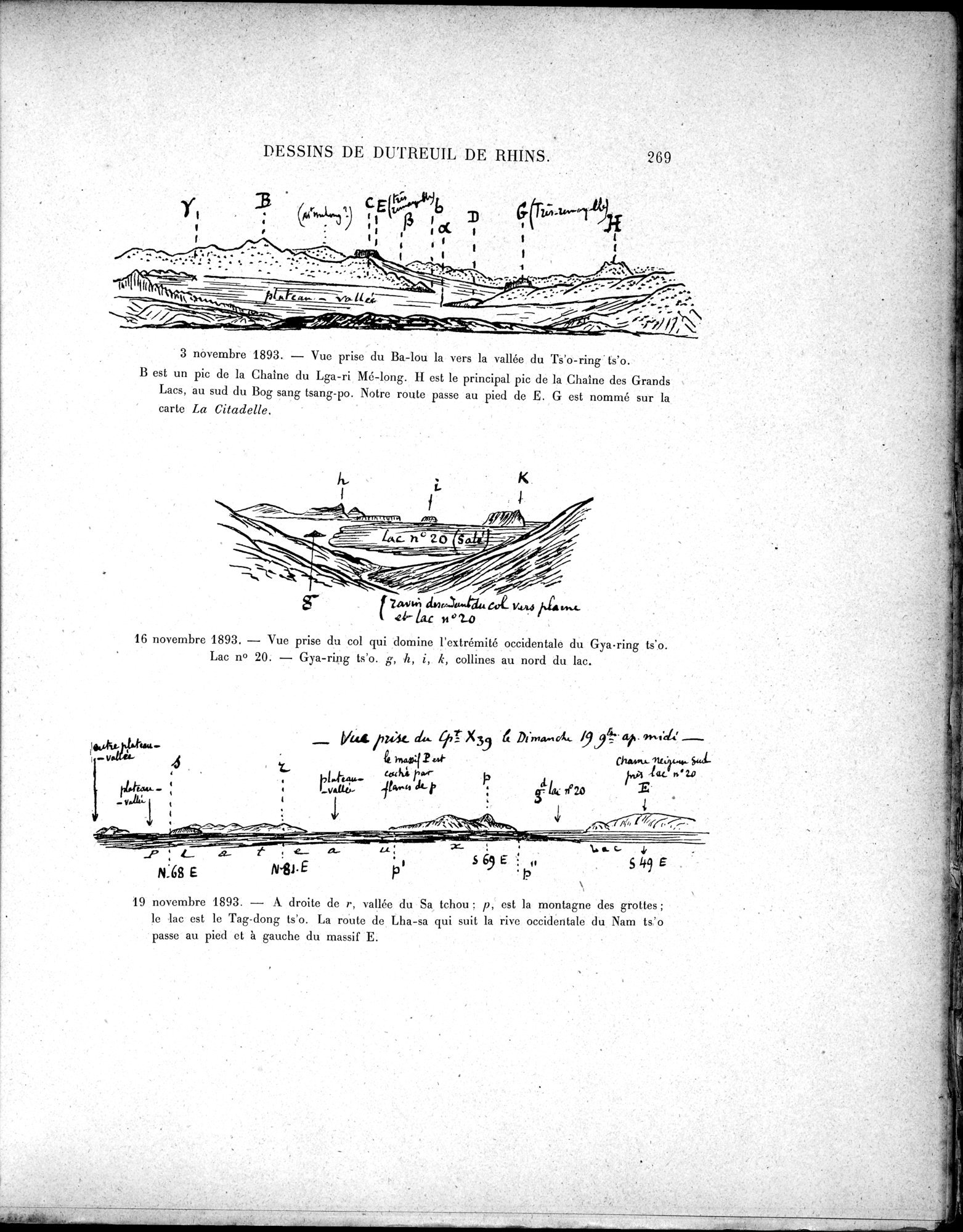 |
| 3 November 1893. - View taken from Ba-lou towards the valley of Ts'o-ring ts'o. B is a peek of the mountain chain of Lga-ri Me-long. H is the main peek of the mountain chain of the Great Lakes, in the South of Bog sang tsang-po. Our way passes at the foot of E. G is named on the map La Citadelle.3 novembre 1893. - Vue prise du Ba-lou la vers la vallée du Ts'o-ring ts'o. B est un pic de la Chaîne du Lga-ri Mé-long. H est le principal pic de la Chaîne des Grands Lacs, au sud du Bog sang tsang-po. Notre route passe au pied de E. G est nommé sur la carte La Citadelle. | |
| 16 November 1893. - View taken from the pass which dominates the eastern edge of Gya-ring ts'o. Lake no 20. - Gya-ring t'so. g,h,i,k, hills in the North of the lake.16 novembre 1893. - Vue prise du col qui domine l'extrémité occidentale du Gya-ring ts'o. Lac no 20. - Gya-ring t'so. g,h,i,k, collines au nord du lac. | |
| 19 November 1893. - In the right of r, valley of Sa tchou : p, is the mountain of caves; the lake is the Tag-dong ts'o. The road from Lha-sa which follows the western shore of Nam ts'o passes at the foot and left of massif E.19 novembre 1893. - A droite de r, vallée du Sa tchou : p, est la montagne des grottes ; le lac est le Tag-dong ts'o. La route de Lha-sa qui suit la rive occidentale du Nam ts'o passe au pied et à gauche du massif E. |
3 novembre 1893. — Vue prise du Ba-lou la vers la vallée du Ts'o-ring ts'o.
B est un pic de la Chaîne du Lga-ri Md-long. II est le principal pic de la Chaîne des Grands Lacs, au sud du Bog sang tsang-po. Notre route passe au pied de E. G est nommé sur la carte La Citadelle.
16 novembre 1893. — Vue prise du col qui domine l'extrémité occidentale du Gya•ring ts'o. Lac n° 20. — Gya-ring ts'o. g, h, i, k, collines au nord du lac.
19 novembre 1893. — A droite de r, vallée du Sa tchou ; p, est la montagne des grottes ; le lac est le Tag-dong ts'o. La route de Lha-sa qui suit la rive occidentale du Nam ts'o passe au pied et à gauche du massif E.
DESSINS DE DUTREUIL DE RI-IINS.
269
Yt
r
r ~ CE
~) 1~
- rr
l.:
r• %'
:~~//~;~
ru;st- ÿ,* x39 99~
te kuoqz,.4.
eeuf. wr p
; h~~' .
I
•• r 01771
•
\~ V1?áty•■'■
sa<4-
{.,A n' 20
Z. .
/4~i. ~%/~ . r •
n♦ .
-
p 49.- t e__
N.68 E N'81•E
S69 h
L < <- y
Sk9E
|
Copyright (C) 2003-2019 National Institute of Informatics and The Toyo Bunko. All Rights Reserved.