国立情報学研究所 - ディジタル・シルクロード・プロジェクト
| |||||||||
|
| Southern Tibet : vol.4 | |
| 南チベット : vol.4 |
 |
THROUGH THE KARA-KORUM VALLEYS.
6
background of which a snow-covered ridge is to be seen. The rock is limestone, marble and leptite, and is coloured white, yellow and black.
The bottom of the valley being nearly flat to the eye, it is difficult to say
where the water-parting threshold between Pang-gong-1s° and the Indus is situated. It seems, however, to be at the place where a mani and a cairn with rags are built. Here I got the height of 4,329 m. East of this place the ground falls decidedly in the direction of the Panggong-tso, but only for a short distance, for then again the ground seems to be nearly flat. The road follows an old river-bed between
erosion terraces, through which at an earlier epoch the Panggong-tso drained to the Indus. At the point where the Pobrang brook emptied some 2 or 3 cub. m. of water per second into the lake, and where the height is 4,317 m., we turn northwards along the brook. The right erosion terrace was 51 cm. high and ran out like a cape in the lake. The view of the bluish green lake stretching S. E. between gigantic mountains, is magnificent. Here I left the road I had followed nearly 5 years earlier, on December 15, I 90 I.
The road sticks to the top of the right erosion terrace. The ground is sandy with a few rudimentary dunes and with sparse tussocks. At my first visit the bed was filled with drifting sand which now had disappeared. The accumulation of sand takes place during the dry season, and is swept away as soon as the water again comes down from the melting snows in the spring or early summer. The erosion terrace grows higher; it is soon 2 m., later on 4 or 6 m. high, especially where a scree from the right side of the valley is cut through by the water; here the left terrace is very low or missing altogether, and the bed of the brook is divided into several branches.
Lukkung is the name of a hamlet consisting of two or three stone huts, a chorten, a barley field and a tree. Having turned in a more north-easterly direction, a considerable valley opens up in front of us bounded in the west by a mighty mountain ridge. The bottom of this valley is covered with stones and blocks. Diagonally crossing a little ridge of hills, the highest point of which is marked with two small manis, we came down into the Pobrang valley with the little village of the same name, the last in this direction.
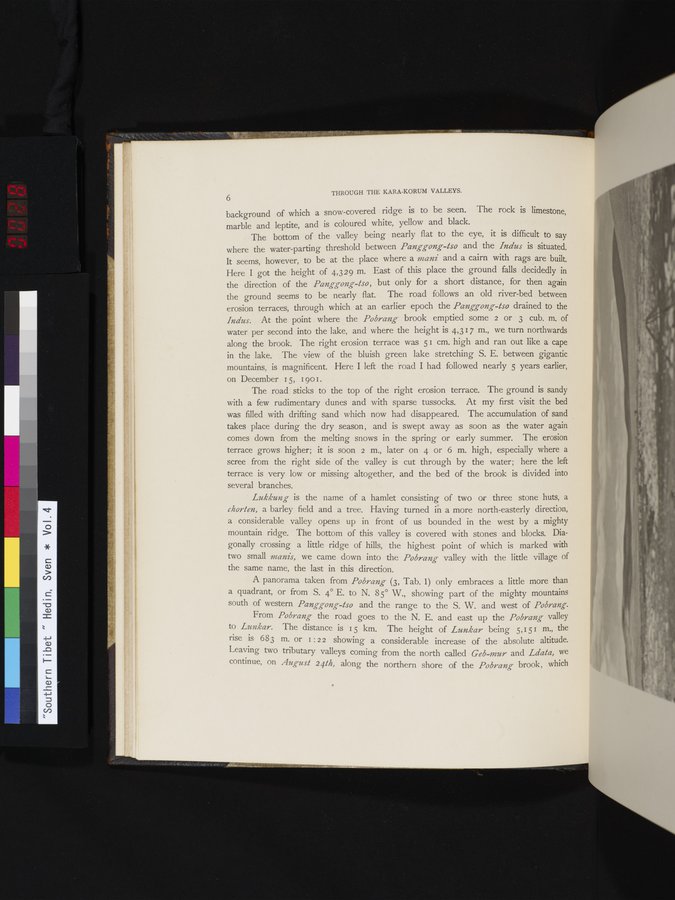
A panorama taken from Pobrang (3, Tab. 1) only embraces a little more than a quadrant, or from S. 4° E. to N. 85° W., showing part of the mighty mountains south of western Panggong-tso and the range to the S. W. and west of Pobrang.
From Pobrang the road goes to the N. E. and east up the Pobrang valley to Lunkar. The distance is 15 km. The height of Lunkar being 5,151 m., the rise is 683 m. or I : 2 2 showing a considerable increase of the absolute altitude. Leaving two tributary valleys coming from the north called Geb-mur and Ldata, we continue, on August 24th, along the northern shore of the Pobrang brook, which
11
|
Copyright (C) 2003-2019
National Institute of Informatics(国立情報学研究所)
and
The Toyo Bunko(東洋文庫). All Rights Reserved.
本ウェブサイトに掲載するデジタル文化資源の無断転載は固くお断りいたします。