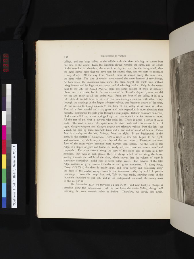
| | 198 THE JOURNEY TO TANKSE. valleys, and one large valley in the middle with the river winding its course from one side to the other. Even the direction always remains the same, and the effects of the sunshine is, therefore, the same from day to day. In the background, rises the same snowy mass that we have seen for several days, and we seem to approach it very slowly. All the way from Gartok, there is always nearly the same view, the same relief. The laws of erosion have caused the same features of morphology. At both sides, the mountains have about the same height the whole way, without being interrupted by high snow-covered and dominating peaks. Only in the mountains to the left, the Ladak Range, there are some patches of snow in shadowy places near the crests, but in the mountains of the Transhimalayan System, we did not see any snow at all the entire way. From the floor of the valley, it is, as a rule, difficult to tell how far it is to the culminating crests on both sides. Only through the openings of the larger tributary valleys, one becomes aware of the crest. On the section to Camp CCLXIV, the floor of the valley is as even as before. The soil is fine material and clay ; grass and bush vegetation is more abundant than hitherto. Sometimes the path goes through a real jungle. Rabbits' holes are numerous. Ducks are still living where springs keep the river open for a few meters or more. All the rest of the river is covered with solid ice. There is again a series of mani walls. The road is, as a rule, quite near the river, only twice its course is out of sight, Gangra-kongma and Gangra-yogma are tributary valleys from the left. At Tavuk, we pass by three miserable tents and a low wall of sun-dried bricks. Tabu-kam is a valley to the left, Pelung, from the right. In the background of the latter, is the district of Dungsum. Here a ridge of low hills begins to our right, and continues the whole way to, and beyond the next camp. Therefore, the even floor of the main valley becomes more narrow than before. At the foot of this ridge, is a steppe of grass and bushes on sandy soil, and there are several mani and ring-walls. The river sweeps along the base of the ridge and is open at a few stretches. But even at such places, there is always a belt of ice along the banks, sloping towards the middle of the river, which proves that the volume of water is constantly decreasing. Solid rock is never within reach. The detritus of the little ridge consists of grey quartz-biotite-diorite and green sandstone. At Lung-kung, Camp CCLXI V the river is nearly open, and flows slowly and noicelessly along the base of the Ladak Range towards the transverse valley by which it pierces this range. From this camp, Pan. 368, Tab. 65, was made, showing some of the mountain shoulders to our left, and in the background, as usual, the snowy mass to the N. 38° W. On November 21M, we travelled 24 km. N. W., and now finally a change is entering along this monotonous road, for we leave the Indus Valley, though still following the same tectonic valley as before. Therefore, we slowly rise again. |