国立情報学研究所 - ディジタル・シルクロード・プロジェクト
| |||||||||
|
| Southern Tibet : vol.4 | |
| 南チベット : vol.4 |
 |
226 LATITUDINAL VALLEYS OF THE CHANG-TANG.
covered ranges are seen at a great distance. This picturesque landscape was sketched
in water colours.
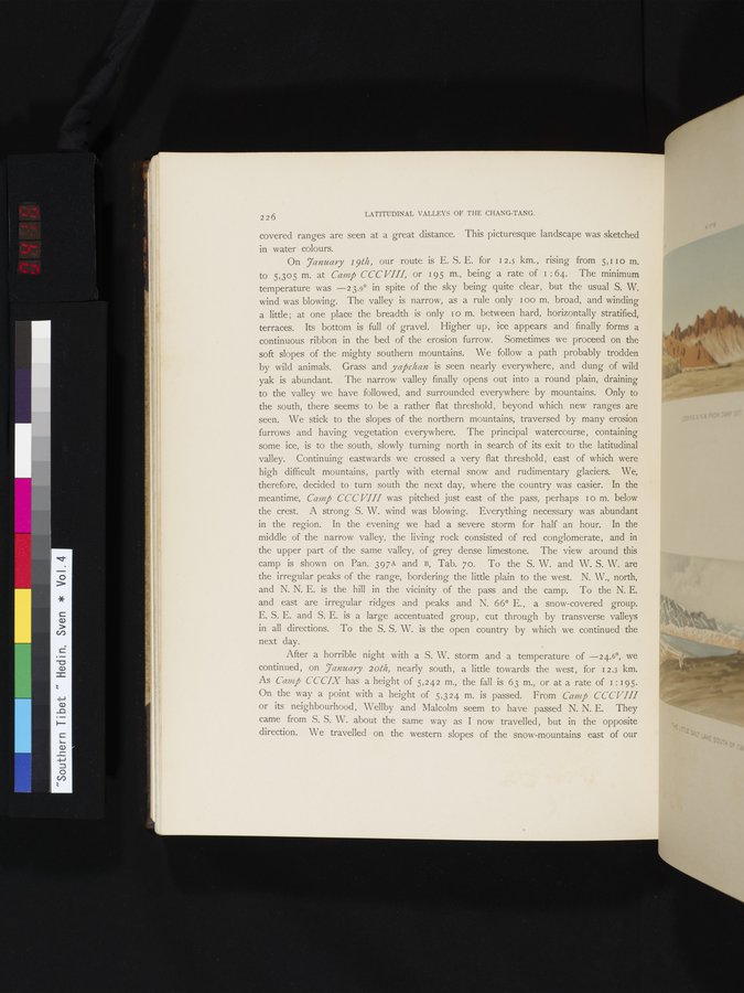
On 7anuary 19th, our route is E. S. E. for 12.5 km., rising from 5,11 0 m. to 5,305 m. at Camp CCC VIII, or 195 m., being a rate of i : 64. The minimum temperature was —23.9° in spite of the sky being quite clear, but the usual S. W. wind was blowing. The valley is narrow, as a rule only I oo m. broad, and winding a little ; at one place the breadth is only 1 o m. between hard, horizontally stratified, terraces. Its bottom is full of gravel. Higher up, ice appears and finally forms a continuous ribbon in the bed of the erosion furrow. Sometimes we proceed on the soft slopes of the mighty southern mountains. We follow a path probably trodden by wild animals. Grass and yapchan is seen nearly everywhere, and dung of wild yak is abundant. The narrow valley finally opens out into a round plain, draining to the valley we have followed, and surrounded everywhere by mountains. Only to the south, there seems to be a rather flat threshold, beyond which new ranges are seen. We stick to the slopes of the northern mountains, traversed by many erosion furrows and having vegetation everywhere. The principal watercourse, containing some ice, is to the south, slowly turning north in search of its exit to the latitudinal valley. Continuing eastwards we crossed a very flat threshold, east of which were high difficult mountains, partly with eternal snow and rudimentary glaciers. We, therefore, decided to turn south the next day, where the country was easier. In the meantime, Camp CCCVIII was pitched just east of the pass, perhaps I o m. below the crest. A strong S. W. wind was blowing. Everything necessary was abundant in the region. In the evening we had a severe storm for half an hour. In the middle of the narrow valley, the living rock consisted of red conglomerate, and in the upper part of the same valley, of grey dense limestone. The view around this camp is shown on Pan. 397A and B, Tab. 7o. To the S. W. and W. S. W. are the irregular peaks of the range, bordering the little plain to the west. N. W., north, and N. N. E. is the hill in the vicinity of the pass and the camp. To the N. E. and east are irregular ridges and peaks and N. 66° E., a snow-covered group. E. S. E. and S. E. is a large accentuated group, cut through by transverse valleys in all directions. To the S. S. W. is the open country by which we continued the next day.
After a horrible night with a S. W. storm and a temperature of —24.6°, we continued, on 7anuary 20th, nearly south, a little towards the west, for 12.3 km. As Camp CCCIX has a height of 5,242 m., the fall is 63 m., or at a rate of 1: 19 5 On the way a point with a height of 5,324 m. is passed. From Camp CCCVIII or its neighbourhood, Wellby and Malcolm seem to have passed N. N. E. They came from S. S. W. about the same way as I now travelled, but in the opposite direction. We travelled on the western slopes of the snow-mountains east of our
|
Copyright (C) 2003-2019
National Institute of Informatics(国立情報学研究所)
and
The Toyo Bunko(東洋文庫). All Rights Reserved.
本ウェブサイトに掲載するデジタル文化資源の無断転載は固くお断りいたします。