国立情報学研究所 - ディジタル・シルクロード・プロジェクト
| |||||||||
|
| Southern Tibet : vol.4 | |
| 南チベット : vol.4 |
 |
320 TO THE FRONTIER OF BRITISH INDIA.
The river of the Mangnang valley was divided into several branches, the joint breadth of which amounted to 66 m., the average depth was 0.25 m., the average velocity 1.2 m., and the volume about 20 cub. m. per second. So far, we had controlled 2 3 o cub. m. of water to the Sallej. On the left side are meadows, and here the gomfta is situated. The village consists of 3 or 4 houses with walls, and the barley fields are larger than hitherto. The harvest would take place in a month. Ten days before, i. e. August 2nd, the Mangnang- tsangpo had been very swollen and difficult to cross. The river was said to come from a mountain, Gangmengangri, 2 or 3 days S. W. The real name of the monastery was given as MangnangChangchughling--gompa.
On August r3th, we travelled 21 km. N. N. E. and N. W. Here at last we got a means of determining how great was the difference of altitude between a part of our road in the bottom of a tributary, and the Sallej itself. In the valley of Mangnang, the height was 4,016 m., and at Tolling, au niveau with the Sallej, it was 3,700 m., or 316 m. lower. In this distance of 21 km., the rate of fall was, therefore, as I : 66, disregarding the accentuated relief of the surface. We may, therefore, approximately, fix the fall of the lower parts of the southern tributaries at I : 66.
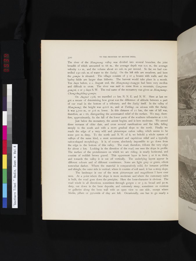
Just below the monastery, the ascent begins, and is here moderate. We ascend three terraces of older date, and cross several ramifications and flat hills, falling steeply to the south and with a more gradual slope to the north. Finally we reach the edge of a very wild and picturesque canon valley, which seems to be some 300 m. deep. To the north and N. W. of it, we behold a whole system of valleys of the same kind, a most accentuated and capricious relief and a typically canon-shaped morphology. It is, of course, absolutely impossible to go down from the edge to the bottom of this valley. The road, therefore, follows the very edge for about 2 km. Looking in the direction of the road, one sees the slope in profile. The surface of the protuberance on which we are riding, is nearly horizontal, and
consists of reddish brown gravel. This uppermost layer is here 5 or 6 m. thick, and towards the valley it is cut off vertically. The underlying layers appear in different colours and of different consistence. Some are light grey or green, others somewhat darker. Where the material is comparatively solid, for instance pebbles and shingle, the outer side is vertical; where it consists of soft sand, it has a steep slope.
The landscape is one of the most picturesque and magnificent I have ever
seen. At a point where the slope is more moderate and where the customary cairn is built, the road goes down the precipice. Here the loess-character is obvious. The road winds in all directions, sometimes through gorges 2 or 3 m. broad and 3o m. deep, cut down in the loess deposits, and extremely steep, sometimes on cornices or galleries along the loess wall with an open view to one side , except where blocks, pillars or pyramids of clay are left. Occasionally, one has to go nearly a
|
Copyright (C) 2003-2019
National Institute of Informatics(国立情報学研究所)
and
The Toyo Bunko(東洋文庫). All Rights Reserved.
本ウェブサイトに掲載するデジタル文化資源の無断転載は固くお断りいたします。