国立情報学研究所 - ディジタル・シルクロード・プロジェクト
| |||||||||
|
| Southern Tibet : vol.4 | |
| 南チベット : vol.4 |
 |
.,1447" -
8
THROUGH THE KARA-KORUM VALLEYS.
of the Slang-lung valley. In this direction the water goes down to the Chang-chenino River, which is a tributary to the Shayok and the Indus. On the Marsiinik-la we are, therefore, again on a very important water-parting, the water at one side flowing to the Panggong-iso, and at the other to the Indian Ocean.
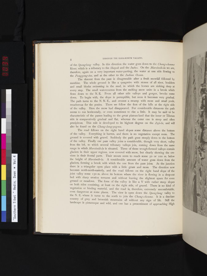
The descent from the pass is disagreeable after a fresh snowfall followed by sunshine. The whole ground is like a quagmire with stones of all sizes, boulders and small blocks swimming in the mud, in which the horses are sinking deep at every step. The small watercourses from the melting snow unite in a brook which flows down to the N. E. From all other side valleys and gorges, brooks come down. To begin with, the slope is perceptible, but soon it becomes very gradual. The path turns to the N. N. E., and crosses a swamp with moss and small pools, treacherous for the ponies. There we follow the foot of the hills at the right side of the valley. Here the snow had disappeared. For considerable distances the path seems to run horizontally, or even sometimes to rise a little. It may be said tei be characteristic of the passes leading to the great plateau-land that the inner or Tibetan side is comparatively gradual and flat, whereas the outer one is steep and often precipitous. This rule is developed to its highest degree on the Zoji-la, and will also be found on the Chang-lung yognia.
The road follows on the right hand slopes some distance above the bottom of the valley. Everything is barren, and there is no vegetation except moss. The ground is covered with gravel. Suddenly the path goes steeply down to the bottom of the valley. Finally our pass valley joins a considerable, though very short, valley from the left, to which several tributary valleys join, coming down from the same range in which Marsimik-la is situated. Three of these trough-formed valleys contain glaciers in their upper regions, now covered with snow, but clearly showing the crevices in their frontal parts. Their snouts seem to reach some 50 or wo m. below the height of Marsimik-la. A considerable amount of water goes down from the glaciers, forming a brook with which the one from the pass joins. At the junction there is a triangular open place with a little grass and moss. The direction now becomes north-north-easterly, and the road follows on the right hand slope of the joint valley some 150 m. above its bottom where the river is flowing in a deep-cut bed with sharp erosion terraces and without leaving the slightest space for even ground or meadows. The form of the valley is like a V with rather steep slopes on both sides consisting, at least on the right side, of gravel. There is no kind of vegetation or binding material, and the road is, therefore, extremely uncomfortable, even dangerous at some places. The view is open down the Spans-lung- valley to the N. E. where it turns to the north to join the Chang-chenmo. It is a desolate country of grey and brownish mountains all without any sign of life. Still the landscape is picturesque and wild, and one has a presentiment of approaching High
|
Copyright (C) 2003-2019
National Institute of Informatics(国立情報学研究所)
and
The Toyo Bunko(東洋文庫). All Rights Reserved.
本ウェブサイトに掲載するデジタル文化資源の無断転載は固くお断りいたします。