国立情報学研究所 - ディジタル・シルクロード・プロジェクト
| |||||||||
|
| Southern Tibet : vol.4 | |
| 南チベット : vol.4 |
 |
3r8 TO THE FRONTIER OF BRITISH INDIA.
follows a bit of even ground or tang-a in Tibetan and maidan in the Mohammedan languages. The evenness does, however, not last very long, for we have to cross four or five erosion furrows, one of them very considerable and taking much time. Our direction which so far has been to the west, now turns to the N. W. Four new erosion beds are crossed. Immediately to our left a very deep-cut valley appears,
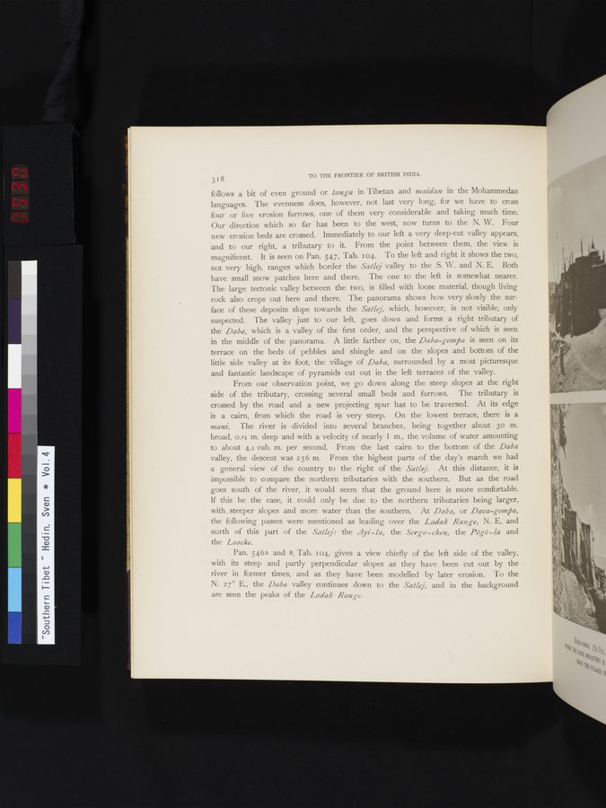
and to our right, a tributary to it. From the point between them, the view is magnificent. It is seen on Pan. 547, Tab. 104. To the left and right it shows the two, not very high, ranges which border the Satlej valley to the S. W. and N. E. Both have small snow patches here and there. The one to the left is somewhat nearer. The large tectonic valley between the two, is filled with loose material, though living rock also crops out here and there. The panorama shows how very slowly the surface of these deposits slope towards the Satlej, which, however, is not visible, only suspected. The valley just to our left, goes down and forms a right tributary of the Daba, which is a valley of the first order, and the perspective of which is seen in the middle of the panorama. A little farther on, the Daba-gompa is seen on its terrace on the beds of pebbles and shingle and on the slopes and bottom of the little side valley at its foot, the village of Daba, surrounded by a most picturesque and fantastic landscape of pyramids cut out in the left terraces of the valley.
From our observation point, we go down along the steep slopes at the right side of the tributary, crossing several small beds and furrows. The tributary is crossed by the road and a new projecting spur has to be traversed. At its edge is a cairn, from which the road is very steep. On the lowest terrace, there is a mani. The river is divided into several branches, being together about 3o m. broad, 0.15 m. deep and with a velocity of nearly 1 m., the volume of water amounting to about 4.5 cub. m. per second. From the last cairn to the bottom of the Daba valley, the descent was 256 m. From the highest parts of the day's march we had a general view of the country to the right of the Satlej. At this distance, it is impossible to compare the northern tributaries with the southern. But as the road goes south of the river, it would seem that the ground here is more comfortable. If this be the case, it could only be due to the northern tributaries being larger, with steeper slopes and more water than the southern. At Daba, or Dava-gompa, the following passes were mentioned as leading over the Ladak Range, N. E. and north of this part of the Satlej : the Ayi - la, the Sergo - chen, the Pögö -la and the Laoche.
Pan. 546A and B, Tab. 104, gives a view chiefly of the left side of the valley, with its steep and partly perpendicular slopes as they have been cut out by the river in former times, and as they have been modelled by later erosion. To the N. 27° E., the Daba valley continues down to the Salle], and in the background are seen the peaks of the Ladak Range.
|
Copyright (C) 2003-2019
National Institute of Informatics(国立情報学研究所)
and
The Toyo Bunko(東洋文庫). All Rights Reserved.
本ウェブサイトに掲載するデジタル文化資源の無断転載は固くお断りいたします。