National Institute of Informatics - Digital Silk Road Project
| |||||||||
|
| Scientific Results of a Journey in Central Asia, 1899-1902 : vol.4 |
 |
TO THE SATSCHU-TSANGPO: A PADDLE DOWN THE SAME. 15
current was slow. The water was decidedly muddy; evidently it had recently been raining somewhere in the adjacent mountains.
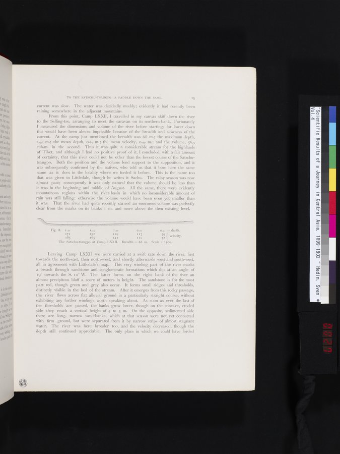
From this point, Camp LXXII, I travelled in my canvas skiff down the river to the Selling-tso, arranging to meet the caravan on its northern bank. Fortunately I measured the dimensions and volume of the river before starting; for lower down this would have been almost impossible because of the breadth and slowness of the current. At the camp just mentioned the breadth was 68 m.; the maximum depth, 1.5o m.; the mean depth, 0.84 m.; the mean velocity, 0.99 m.; and the volume, 56.5 cub.m. in the second. Thus it was quite a considerable stream for the highlands of Tibet, and although I had no positive proof of it, I concluded, with a fair amount of certainty, that this river could not be other than the lowest course of the Satschutsangpo. Both the position and the volume lend support to the supposition, and it was subsequently confirmed by the natives, who told us that it bore here the same name as it does in the locality where we forded it before. This is the name too that was given to Littledale, though he writes it Sachu. The rainy season was now almost past; consequently it was only natural that the volume should be less than it was in the beginning and middle of August. All the same, there were evidently mountainous regions within the river-basin in which no inconsiderable amount of rain was still falling; otherwise the volume would have been even yet smaller than it was. That the river had quite recently carried an enormous volume was perfectly clear from the marks on its banks i m. and more above the then existing level.
Fig. 8. I.50 I.45 I .ro o.70
171 152 I29 I17
185 165 141 IIo
The Satschu-tsangpo at Camp LXXII. Breadth = 68 m.
0.31 = depth.
79 velocity. 72
Scale 1 : 500.
Leaving Camp LXXII we were carried at a swift rate down the river, first towards the north-east, then north-west, and shortly afterwards west and south-west, all in agreement with Littledale's map. This very winding part of the river marks a breach through sandstone and conglomerate formations which dip at an angle of 19° towards the S. t o° W. The latter forms on the right bank of the river an almost precipitous bluff a score of meters in height. The sandstone is for the most part red, though green and grey also occur. It forms small ridges and thresholds, distinctly visible in the bed of the stream. After it emerges from this rocky passage, the river flows across flat alluvial ground in a particularly straight course, without exhibiting any further windings worth speaking about. As soon as ever the last of the thresholds are passed, the banks grow lower, though on the concave, eroded side they reach a vertical height of 4 to 5 m. On the opposite, sedimented side there are long, narrow sand-banks, which at that season were not yet connected with firm ground, but were separated from it by narrow strips of almost stagnant water. The river was here broader too, and the velocity decreased, though the depth still continued appreciable. The only place in which we could have forded
|
Copyright (C) 2003-2019 National Institute of Informatics and The Toyo Bunko. All Rights Reserved.