National Institute of Informatics - Digital Silk Road Project
| |||||||||
|
| Scientific Results of a Journey in Central Asia, 1899-1902 : vol.4 |
 |
CC•
164 WESTWARDS TO LADAK.
part derived from springs; though it will undoubtedly be frozen, perhaps right to the bottom, and will give rise to vast ice-sheets in the floor of the valley. Under these circumstances the presence of the fish would be accounted for by the issue of the river out of a lake, for they can of course retire into it when the river freezes. But end of October though it was, the fish proceeded, as we have seen, as far down as the vicinity of the salt lake. As for the gypsum expanse near the embouchure, it narrows rapidly up-stream to a tapering point, though above that there are still a few detached patches. It is just possible, that what the Cossacks took to be a lake may in reality have been nothing more than another gypsum area. Anyway the point cannot be settled until after a fresh journey. The valley of the river Lakor would certainly offer a convenient road into southern Tibet and the regions in which Nain Singh's great lakes are situated.
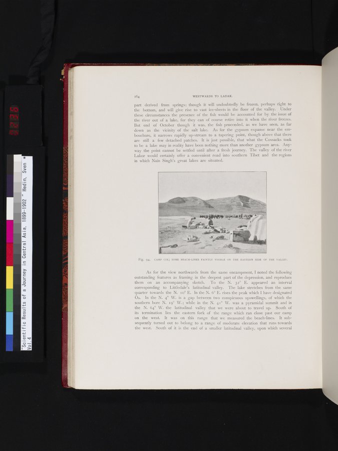
Fig. 94. CAMP CIX; SOME BEACH-LINES FAINTLY VISIBLE ON THE EASTERN SIDE OF THE VALLEY.
As for the view northwards from the same encampment, I noted the following outstanding features as framing in the deepest part of the depression, and reproduce them on an accompanying sketch. To the N. 32° E. appeared an interval corresponding to Littledale's latitudinal valley. The lake stretches from the same quarter towards the N. Io° E. In the N. 6° E. rises the peak which I have designated 02. In the N. 4° W. is a gap between two conspicuous upswellings, of which the southern bore N. 19° W.; while in the N. 41° W. was a pyramidal summit and in the N. 64° W. the latitudinal valley that we were about to travel up. South of its termination lies the eastern fork of the range which ran close past our camp on the west. It was on this range that we measured the beach-lines. It subsequently turned out to belong to a range of moderate elevation that runs towards the west. South of it is the end of a smaller latitudinal valley, upon which several
|
Copyright (C) 2003-2019 National Institute of Informatics and The Toyo Bunko. All Rights Reserved.