National Institute of Informatics - Digital Silk Road Project
| |||||||||
|
| Scientific Results of a Journey in Central Asia, 1899-1902 : vol.4 |
 |
358 WESTWARDS TO LADAK.
history, showing that during the summer the river must swell to very respectable dimensions. In consequence of the shape of the bed the breadth does not increase very much at the point in question; but on the other hand the depth and the velocity both increase all the more. At the same time it is amazing how the bridges, both here and lower down, considering their fragile construction, are able to withstand
the pressure of the summer flood.
~
{
We travelled, then, along the right bank of the Indus, and soon came to a bend, in which the stream was dashing itself with a hollow roar against the almost vertical cliffs; but round this buttress an excellent road has been made at about 20 m. above the river. The erosion terraces on the left bank make sombre shelves, almost wearying in their uniformity; along the flank of the lowest of these terraces runs an irrigation canal, which carries the water up to the top of the terraces and then irrigates the fields around the villages lower down. The mountains on the left side of the river stand a considerable distance back from it. So far as it was possible to judge at a distance, the rocks there appeared to dip 35° to 40° towards the S. 40° W., and owing to the strips of snow which still lay on the outcrops of the strata, the positions of these were well defined.
The valley expands, the mountains on the right also receding a little, and we entered upon a broad, open plain, paved with sandy soil, hard, level, and first-rate for riding on. We passed the villages of Sassoma and Nang; the villages on the left side of the river are more numerous, one of them is called Mato. On our left we passed two detached rocky knolls, rising above the otherwise level expanse; the one farther away was crowned by the temple of Tagsu-gompa. After that came the large, straggling village of Tikse, with its houses and steadings, its sacred stone kists and tschortens indicating the proximity of a temple. In the background the temple of Tikse crowns the top of a projecting headland, and the 40 or 5o lamas
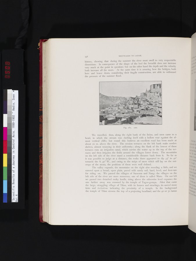
Fig. 2 81. LEH.
|
Copyright (C) 2003-2019 National Institute of Informatics and The Toyo Bunko. All Rights Reserved.