National Institute of Informatics - Digital Silk Road Project
| |||||||||
|
| Scientific Results of a Journey in Central Asia, 1899-1902 : vol.4 |
 |
62 FROM CENTRAL TIBET TO LADAK.
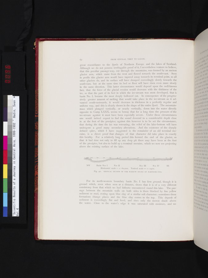
great resemblance to the fjords of Northern Europe and the lakes of Scotland. Although we do not possess irrefragable proof of it, I nevertheless venture to believe, that this peculiar passage-way, cut through the mountains, was formed by an ancient glacier arm, which came from the west and flowed towards the south-east. Seen in profile this glacier arm would have tapered away towards its terminal point, as all other glaciers do, and its surface will have drooped exceedingly slowly towards the south-east, but at the same time its bed or floor will have risen, even more slowly in the same direction. This latter circumstance would depend upon the well-known fact, that the force of the glacial erosion would decrease with the thickness of the ice, so that the part of its bed in which the ice-stream was most developed, that is basin No. I, became the most deeply hollowed out. In consequence of the progressively greater amount of melting that would take place in the ice-stream as it advanced south-eastwards, it would decrease in thickness in a perfectly regular and uniform way, and this is clearly shown in the shape of the entire fjord. The mountain-mass which plunged vertically, or nearly vertically, down into the water directly opposite to Camp LXXX, seems to betray that for a long time the pressure of the ice-stream against it must have been especially severe. Under these circumstances one would indeed expect to find the sound descend to a considerable depth close in at the foot of the precipice; against this however is to be set the circumstance, that during the time the ice was retreating, the relief of the lake-bottom will have undergone a good many secondary alterations. And the existence of the sharply defined »pier», which I have suggested is the remainder of an old terminal moraine, is a direct proof that changes of that character did take place in exactly this locality. For a relatively long period this formed the end of the glacier, so that it had time not only to fill up any deep pit there may have been at the foot of the precipice, but also to build up a terminal moraine, which we now see projecting above the existing surface of the lake.
NW Basin N:o I N:o II
N:o III N:o IV SE
Horizontal scale = i : 6o,000. Vertical scale = i : 2400.
Fig. 40. VERTICAL SECTION OF THE NARROW SOUND OF NAKTSONG-TSO.
For its north-western boundary basin No. I has firm ground, though it is ground which, even when seen at a distance, shows that it is of a very different consistency from that which we had hitherto encountered round this lake. The passage between the mountain walls on both sides is there blocked by fine yellow sediment or mud, resting upon blue clay of a similar soft character; sometimes these formations change places and the blue clay comes to the top. This deposit of sediment is exceedingly flat and level, and rises only the merest shade above the water. Close to the water's edge it was saturated with moisture, and we
|
Copyright (C) 2003-2019 National Institute of Informatics and The Toyo Bunko. All Rights Reserved.