National Institute of Informatics - Digital Silk Road Project
| |||||||||
|
| Scientific Results of a Journey in Central Asia, 1899-1902 : vol.4 |
 |
548
OROGRAPHY OF CENTRAL TIBET.
the Arka-tagh and Kalta-alaghan do form the eastward continuation of the Kwenlun proper, then the Astin-tagh may appropriately be regarded as the westward continuation of the Nan-schan, though this last is so intimately united with the Kwenlun that it appears to run continuously with the northernmost border-range of that system, the range, I mean, which is pierced by some of the streams that make their way down into the Tarim basin.
~-'" -
,~, /. \ '=, . ~- --~ , ~
~~ , ~ ~---_~..,_ ~ ► ~
'~—~ ,,~~ ~ (~ ~
;~ \ a`_/~' \
s\ , ~'- ~ / ~ ~~~
~._, . ~4 ,
, ~ ~ ' f j /~~
~~ ~''~~ ~~ y ~ v‘; ~ r /~i ~.
,~ i
/ ; ~,"~l ~ ~, 1 ~ ~' , !v , ~~ }~ % I~l N.ti / ~a ( >>:,..,-
%J!~1~~ `; r ~~ )/~" ~+~ ~/~ ,it~~-' ~~ / t I~ f . ~\ ~` L
— — — , l ~- _, ,~,~ ~~.~ , r l~ - ~~ > ~
~ 11 ~.y / ~ 4-41 ►1 ~. . - ,. --~.,,.,_
{•~ 11 ,~ d rl ~ ~ -Î ,,: ;; ~ .•~, ~ 1 Y'~~ ~"~!I 4"~lf' .~~ , ~ ÿÎ~ J/ ~~ I l ,~~, J~~ ~ ~.+ 7..._;v---/c. d~i , 0114. ul ,.~~4i1 ,~ ►~,~1,y~ ( ~f% i il ~I ~.~, ,~..
,h ~, ~ r*-' . _ ,rn'f;i~~~'''ti-~ ~ ~ ` ~~_~\ l''I /~~ ' / ~_ ~~iÉ I ' (/ ~ '~~ r•, _
y ,~~ ~ lûW•~ ~ I ~~ i(t~? l4~ y ' ~) ~ ~ ~ ~~~ ,~,.r?,,....,-, ~ Pr
, ~ ~Q 1 ` p ~ / ~i/ ;;~-,',ilia / , 7 /û , ~ ~ 3 ~ ~~,~..~ ~~~~ ~ ~i~~
1' C .1~r/ 11 l'7 ~il. ~ ,I.ti r,l/~~ ~~~NM.. ~/~'j ~^ ./\ 1
~ ~ ~J' ~l.n ~h ,i. ~/~'~'~ Ÿ~ .~~'~i I~ ..~`q 1~
1 ~ ~
.~ _ ~~3
~
,~~..
J . `
( \N\
I
~u
~ /i//i/
kS ~r
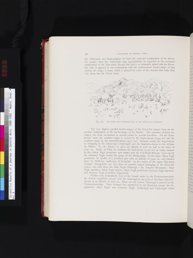
Fig. 360. VIEW FROM THE NORTHERN FOOT OF THE KWEN-LUN MOUNTAINS.
The two highest parallel border-ranges of the Kwen-lun proper form an immediate continuation of the border-range of the Pamirs. The existence of those two ranges has been ascertained at several points by several travellers. On the Karakorum route the southern range is crossed by the Suget-davan (5434 m.) and the northern range by the Sandschu-davan (4977 m.). Grenard counts the Suget-davan as belonging to the Altyn-tagh (Astin-tagh) and the Sandschu-davan to the »Chaîne du Kilian». To the former he gives an altitude of 526o in. and to the latter of 5040 m. South of Pulur he mentions the Kisil-davan (5156 m.) as being situated in the »Altyn Tagh postérieur» and names also the »Col Kouk Bouyan» (5700 m.) in the »Oustoun Tagh» beside the gorge of the Kerija-darja. In the same »Altyn Tagh postérieur» he speaks of a nameless pass with an altitude of 5440 m., and situated close to Sarik-tus, south-east of Sourghak. In the region of the upper Nija-darja Grenard distinguishes no less than six parallel ranges belonging to the Kwen-lun system, and calls them the Aldy Tagh (Aldi-tagh = the Anterior Mountains), Altyn Tagh antérieur, Altyn Tagh moyen, Altyn Tagh postérieur, Oustoun Tagh antérieur, and Oustoun Tagh postérieur respectively.
Farther east, immediately west of the breach made by the Tschertschen-darja, the French expedition crossed over the Astin-tagh by the pass of »Zarchou» (Sarschudavan) at an altitude of 4780 m. There too the Lower Astin-tagh is pierced by the Tschertschen-darja. Thus Grenard has transferred to the Kwen-lun proper the designations »Altyn Tagh» and »Oustoun Tagh» (Astin-tagh and Ustun-tagh) which
~Y~l. • `1/4 •
|
Copyright (C) 2003-2019 National Institute of Informatics and The Toyo Bunko. All Rights Reserved.