National Institute of Informatics - Digital Silk Road Project
| |||||||||
|
| Scientific Results of a Journey in Central Asia, 1899-1902 : vol.4 |
 |
ICE AND SOUNDINGS IN THE TSO-NGOMIBO. 307
the Panggong-tso to the Tso-ngombo. The first-named is always the final reservoir and always the lower, and the freshwater lake has always the larger drainage-area. In any case the subsidence takes place so slowly that the erosion may very easily keep pace with it. If however the general desiccation of the climate is continued in this part of Tibet also, it is conceivable that some day the inflow into the Tsongombo will be so infinitesimally small that it will be counterbalanced by the evaporation, so that the lake will then be unable any longer to discharge its contents. Not until that happens will the two lakes become disconnected one from the other, and the consequence of this will be that the Panggong-tso, its constant inflow being cut off, will drop even more rapidly than before, while the Tso-ngombo will in the meantime become gradually changed into a salt-water lake. This fate has already overtaken the Panggong-tso, and when we reached its western end, we found there a very low sill or threshold, over which the lake formerly possessed an outflow to the Indus.
~, ~
ô m
e°n o .°. 'ô e «:åo°ov~i°û,éaô~°nåinnv~i.°.ô~.°.~°n°~~°n~PnPP~ Ô ~O in N m ■O ininå å å å å å å å å å å å in -e4 å å å å 1.114
å å å å å
~
s
a~o
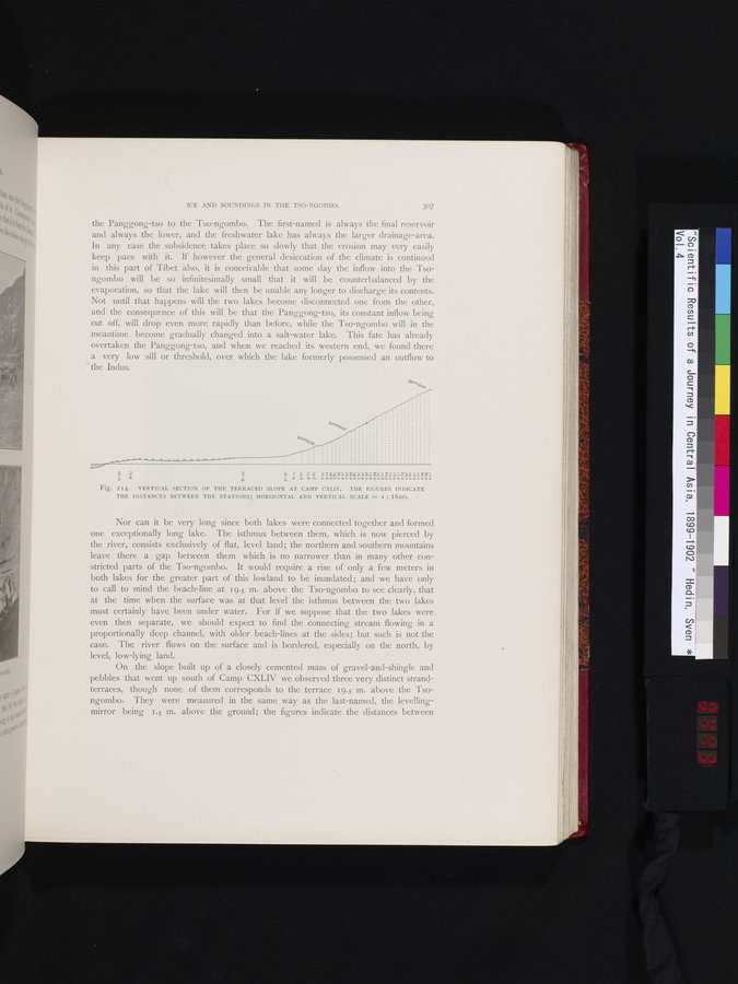
Fig. 214. VERTICAL SECTION OF THE TERRACED SLOPE AT CAMP CXLIV. THE FIGURES INDICATE THE DISTANCES BETWEEN THE STATIONS; HORIZONTAL AND VERTICAL SCALE = I : I600.
Nor can it be very long since both lakes were connected together and formed one exceptionally long lake. The isthmus between them, which is now pierced by the river, consists exclusively of flat, level land; the northern and southern mountains leave there a gap between them which is no narrower than in many other constricted parts of the Tso-ngombo. It would require a rise of only a few meters in both lakes for the greater part of this lowland to be inundated ; and we have only to call to mind the beach-line at 19.5 m. above the Tso-ngombo to see clearly, that at the time when the surface was at that level the isthmus between the two lakes must certainly have been under water. For if we suppose that the two lakes were even then separate, we should expect to find the connecting stream flowing in a proportionally deep channel, with older beach-lines at the sides; but such is not the case. The river flows on the surface and is bordered, especially on the north, by level, low-lying land.
On the slope built up of a closely cemented mass of gravel-and-shingle and pebbles that went up south of Camp CXLIV we observed three very distinct strand-terraces, though none of them corresponds to the terrace 19.5 m. above the Tsongombo. They were measured in the same way as the last-named, the levelling-mirror being 1.5 m. above the ground; the figures indicate the distances between
|
Copyright (C) 2003-2019 National Institute of Informatics and The Toyo Bunko. All Rights Reserved.