National Institute of Informatics - Digital Silk Road Project
| |||||||||
|
| Scientific Results of a Journey in Central Asia, 1899-1902 : vol.4 |
 |
TO "l'IiE LAKOR-TSO. ANCIENT BEACH-LINES.
149
bed. We did not see a single drop of water all day, nor springs either, and the grass hardly deserved the name of grass. Nor did we perceive either tents or any indications of nomads having visited the region. The nearest range to the south now increased in size, and assumed the character of a sharp, wild, rocky crest, with a steep gravelly scree at its foot, scored by dry torrents. The northern range, consisting of the same rock as heretofore, is on the other hand lower, with longer, gentler declivities towards the main watercourse of the valley. The side-gullies which seam it are shallower and less numerous. The westward inclination of the valley, which was at first distinguishable, grows at last of the very slightest. Crossing the middle of the gathering-basin in which we had been travelling ever since leaving the last pass, we began to ascend slowly towards the threshold which borders it on the west. In point of construction this gathering-basin is unusual. It possesses two main watercourses, which descend one from each of the passes mentioned, and after picking up several contributories, join together to
form one stream. This finds its way out of the latitudinal valley by a transverse glen, which, contrary to all its predecessors, proceeds south, piercing the great rocky range which rises on that side. Upon the middle of the basin, which is more broken, converge two moderate-sized watercourses that issue out of a culminating portion of the range to the north. The southern range also culminates on the left side of the transverse glen, rising into heights of a grand and imposing character. Through this transverse glen
we obtained a fresh perspective towards the south, across a latitudinal valley
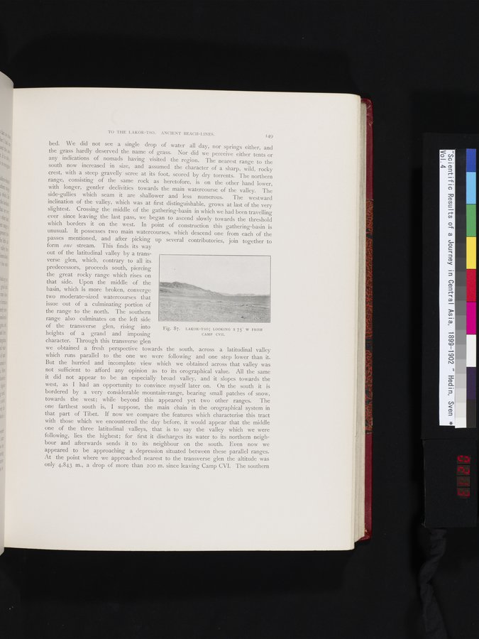
Fig. 87. LAKOR-TSO; LOOKING S 75° W FROM CAMP CVII.
which runs parallel to the one we were following and one step lower than it. But the hurried and incomplete view which we obtained across that valley was not sufficient to afford any opinion as to its orographical value. All the same it did not appear to be an especially broad valley, and it slopes towards the west, as I had an opportunity to convince myself later on. On the south it is bordered by a very considerable mountain-range, bearing small patches of snow, towards the west; while beyond this appeared yet two other ranges. The one farthest south is, I suppose, the main chain in the orographical system in that part of Tibet. If now we compare the features which characterise this tract with those which we encountered the day before, it would appear that the middle one of the three latitudinal valleys, that is to say the valley which we were following, lies the highest; for first it discharges its water to its northern neighbour and afterwards sends it to its neighbour on the south. Even now we appeared to be approaching a depression situated between these parallel ranges. At the point where we approached nearest to the transverse glen the altitude was only 4,843 m., a drop of more than 200 m. since leaving Camp CVI. The southern
|
Copyright (C) 2003-2019 National Institute of Informatics and The Toyo Bunko. All Rights Reserved.