National Institute of Informatics - Digital Silk Road Project
| |||||||||
|
| Scientific Results of a Journey in Central Asia, 1899-1902 : vol.4 |
 |
TRAVELLING BESIDE THE BOGTSANG-TSANGPO. I I 3
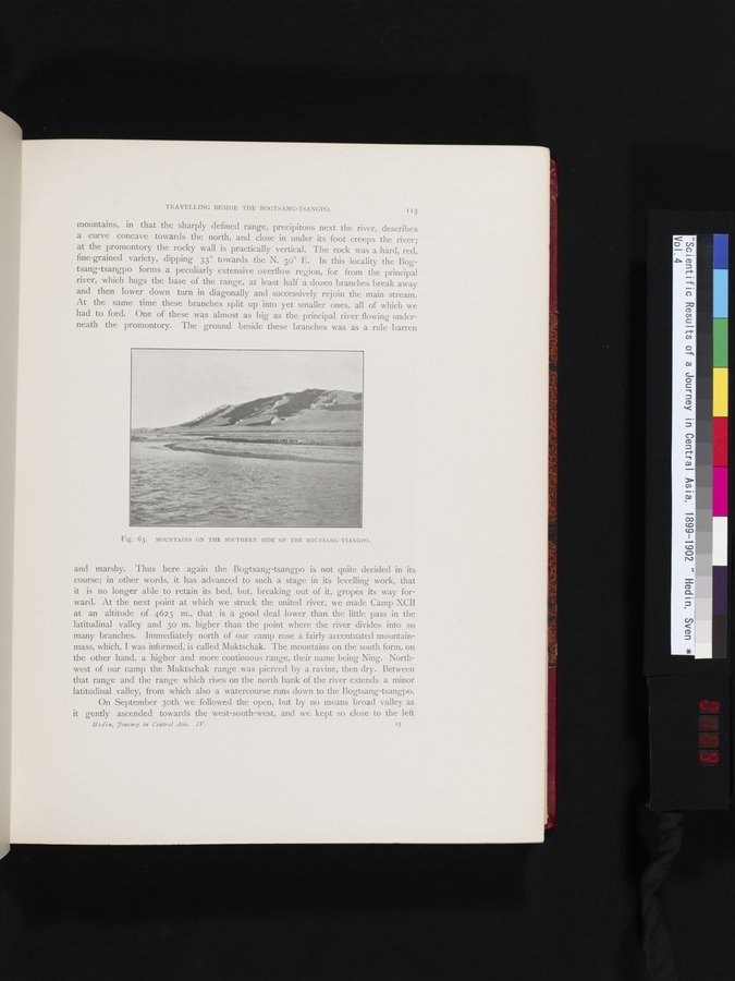
mountains, in that the sharply defined range, precipitous next the river, describes a curve concave towards the north, and close in under its foot creeps the river; at the promontory the rocky wall is practically vertical. The rock was a hard, red, fine-grained variety, dipping 33° towards the N. 3o° E. In this locality the Bogtsang-tsangpo forms a peculiarly extensive overflow region, for from the principal river, which hugs the base of the range, at least half a dozen branches break away and then lower down turn in diagonally and successively rejoin the main stream. At the same time these branches split up into yet smaller ones, all of which we had to ford. One of these was almost as big as the principal river flowing underneath the promontory. The ground beside these branches was as a rule barren
Fig. 63. MOUNTAINS ON THE SOUTHERN SIDE OF THE BOCTSANG-TSANGPO.
and marshy. Thus here again the Bogtsang-tsangpo is not quite decided in its course; in other words, it has advanced to such a stage in its levelling work, that it is no longer able to retain its bed, but, breaking out of it, gropes its way forward. At the next point at which we struck the united river, we made Camp XCII at an altitude of 4623 m., that is a good deal lower than the little pass in the latitudinal valley and 3o m. higher than the point where the river divides into so many branches. Immediately north of our camp rose a fairly accentuated mountain-mass, which, I was informed, is called Muktschak. The mountains on the south form, on the other hand, a higher and more continuous range, their name being Ning. Northwest of our camp the Muktschak range was pierced by a ravine, then dry. Between that range and the range which rises on the north bank of the river extends a minor latitudinal valley, from which also a watercourse runs down to the Bogtsang-tsangpo.
On September 3oth we followed the open, but by no means broad valley as it gently ascended towards the west-south-west, and we kept so close to the left
Hedin, journey in Central Asia. IV 15
|
Copyright (C) 2003-2019 National Institute of Informatics and The Toyo Bunko. All Rights Reserved.