国立情報学研究所 - ディジタル・シルクロード・プロジェクト
| |||||||||
|
| Scientific Results of a Journey in Central Asia, 1899-1902 : vol.2 | |
| 1899-1902年の中央アジア旅行における科学的成果 : vol.2 |
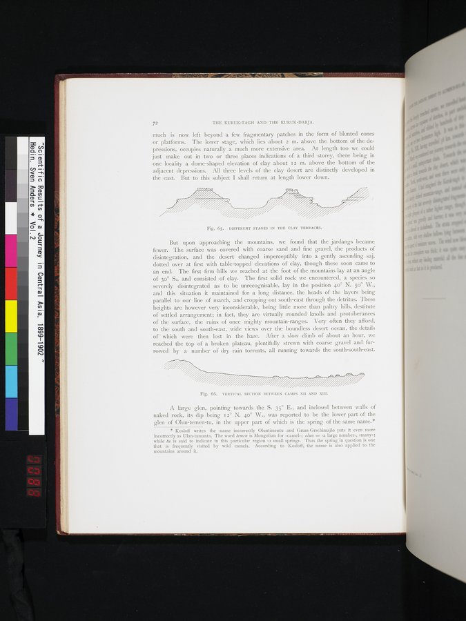 |
| 土の台地の様々な段階。DIFFERENT STAGES IN THE CLAY TERRACES. | |
| 第22~第23キャンプ間の断面図。VERTICAL SECTION BETWEEN CAMPS XII AND XIII. |
72 THE KURUK-TAGH AND THE KURUK-DARJA.
much is now left beyond a few fragmentary patches in the form of blunted cones or platforms. The lower stage, which lies about 2 m. above the bottom of the depressions, occupies naturally a much more extensive area. At length too we could just make out in two or three places indications of a third storey, there being in one locality a dome-shaped elevation of clay about i 2 m. above the bottom of the adjacent depressions. All three levels of the clay desert are distinctly developed in the east. But to this subject I shall return at length lower down.
Fig. 65. DIFFERENT STAGES IN THE CLAY TERRACES.
But upon approaching the mountains, we found that the jardangs became fewer. The surface was covered with coarse sand and fine gravel, the products of disintegration, and the desert changed imperceptibly into a gently ascending saj, dotted over at first with table-topped elevations of clay, though these soon came to an end. The first firm hills we reached at the foot of the mountains lay at an angle of 30° S., and consisted of clay. The first solid rock we encountered, a species so severely disintegrated as to be unrecognisable, lay in the position 4o° N. 50° W., and this situation it maintained for a long distance, the heads of the layers being parallel to our line of march, and cropping out south-east through the detritus. These heights are however very inconsiderable, being little more than paltry hills, destitute of settled arrangement; in fact, they are virtually rounded knolls and protuberances of the surface, the ruins of once mighty mountain-ranges. Very often they afford, to the south and south-east, wide views over the boundless desert ocean, the details of ' which were then lost in the haze. After a slow climb of about an hour, we reached the top of a broken plateau, plentifully strewn with coarse gravel and furrowed by a number of dry rain torrents, all running towards the south-south-east.
Fig. 66. VERTICAL SECTION BETWEEN CAMPS XII AND XIII.
A large glen, pointing towards the S. 35° E., and inclosed between walls of naked rock, its dip being i 2° N. 40° W., was reported to be the lower part of the glen of Olun-temen-tu, in the upper part of which is the spring of the same name.
* Kosloff writes the name incorrectly Oluntimentu and Grum•Grschimajlo puts it even more incorrectly as Ulan-tamanta. The word temen is Mongolian for zcamel»; olun = »a large number», »many»; while to is said to indicate in this particular region »a small spring». Thus the spring in question is one that is frequently visited by wild camels. According to Kosloff, the name is also applied to the mountains around it.
|
Copyright (C) 2003-2019
National Institute of Informatics(国立情報学研究所)
and
The Toyo Bunko(東洋文庫). All Rights Reserved.
本ウェブサイトに掲載するデジタル文化資源の無断転載は固くお断りいたします。