国立情報学研究所 - ディジタル・シルクロード・プロジェクト
| |||||||||
|
| Scientific Results of a Journey in Central Asia, 1899-1902 : vol.2 | |
| 1899-1902年の中央アジア旅行における科学的成果 : vol.2 |
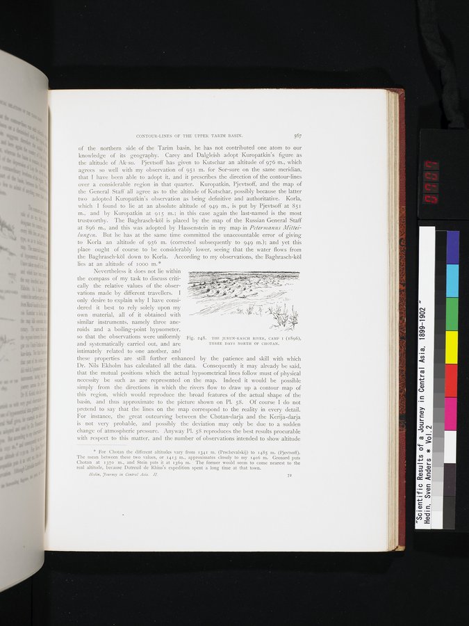 |
| ユルン・カッシュ川、第1キャンプ(1896年)、コータンの北3日のところ。THE JURUN-KASCH RIVER, CAMP 1 (1896), THREE DAYS NORTH OF CHOTAN. |
CONTOUR-LINES OF THE UPPER TARIM BASIN. 567
of the northern side of the Tarim basin, he has not contributed one atom to our knowledge of its geography. Carey and Dalgleish adopt Kuropatkin's figure as the altitude of Ak- su. Pjevtsoff has given to Kutschar an altitude of 976 m., which agrees so well with my observation of 951 m. for Sor-sure on the same meridian, that I have been able to adopt it, and it prescribes the direction of the contour-lines over a considerable region in that quarter. Kuropatkin, Pjevtsoff, and the map of the General Staff all agree as to the altitude of Kutschar, possibly because the latter two adopted Kuropatkin's observation as being definitive and authoritative. Korla, which I found to lie at an absolute altitude of 949 m., is put by Pjevtsoff at 851 m., and by Kuropatkin at 915 m. ; in this case again the last-named is the most trustworthy. The Baghrasch-köl is placed by the map of the Russian General Staff at 896 m., and this was adopted by Hassenstein in my map in Peterranns Mittel- lungen. But he has at the same time committed the unaccountable error of giving to Korla an altitude of 956 m. (corrected subsequently to 949 m.); and yet this place ought of course to be considerably lower, seeing that the water flows from the Baghrasch-köl down to Korla. According to my observations, the Baghrasch-köl lies at an altitude of moo m.
Nevertheless it does not lie within the compass of my task to discuss criti- T
cally the relative values of the obser-
vations made by different travellers. I
only desire to explain why I have consi- ~~- lair
dered it best to rely solely upon my
own material, all of it obtained with
similar instruments, namely three ane
roids and a boiling-point hypsometer,
so that the observations were uniformly Fig. 248. THE JURUN-KASCH RIVER, CAMP I (1896),
and systematically carried out, and are THREE DAYS NORTH OF CHOTAN.
intimately related to one another, and
these properties are still further enhanced by the patience and skill with which Dr. Nils Ekholm has calculated all the data. Consequently it may already be said, that the mutual positions which the actual hypsometrical lines follow must of physical necessity be such as are represented on the map. Indeed it would be possible simply from the directions in which the rivers flow to draw up a contour map of this region, which would reproduce the broad features of the actual shape of the basin, and thus approximate to the picture shown on Pl. 58. Of course I do not pretend to say that the lines on the map correspond to the reality in every detail. For instance, the great outcurving between the Chotan-darja and the Kerija-darja is not very probable, and possibly the deviation may only be due to a sudden change of atmospheric pressure. Anyway Pl. 58 reproduces the best results procurable with respect to this matter, and the number of observations intended to show altitude
* For Chotan the different altitudes vary from 1341 m. (Prschevalskij) to 1485 m. (Pjevtsoff). The mean between these two values, or 1413 m., approximates closely to my 1406 m. Grenard puts Chotan at 1370 m., and Stein puts it at 1369 m. The former would seem to come nearest to the real altitude, because Dutreuil de Rhins's expedition spent a long time at that town.
Hedin, yourney in Central Asia. 11. 72
|
Copyright (C) 2003-2019
National Institute of Informatics(国立情報学研究所)
and
The Toyo Bunko(東洋文庫). All Rights Reserved.
本ウェブサイトに掲載するデジタル文化資源の無断転載は固くお断りいたします。