国立情報学研究所 - ディジタル・シルクロード・プロジェクト
| |||||||||
|
| Scientific Results of a Journey in Central Asia, 1899-1902 : vol.2 | |
| 1899-1902年の中央アジア旅行における科学的成果 : vol.2 |
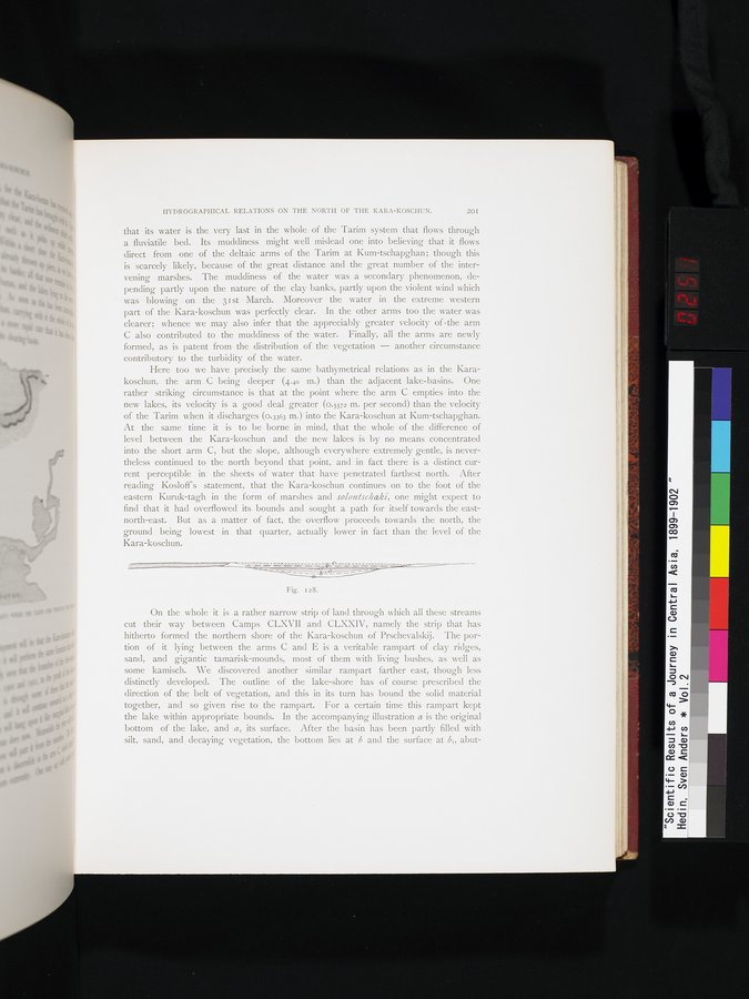 |
| カラ・コシュンにおける山の背の成り行き。Result of ramparts in the Kara-koschun |
HYDROGRAPHICAL RELATIONS ON THE NORTH OF THE KARA-KOSCHUN. 20I
that its water is the very last in the whole of the Tarim system that flows through a fluviatile bed. Its muddiness might well mislead one into believing that it flows direct from one of the deltaic arms of the Tarim at Kum-tschapghan; though this is scarcely likely, because of the great distance and the great number of the intervening marshes. The muddiness of the water was a secondary phenomenon, depending partly upon the nature of the clay banks, partly upon the violent wind which was blowing on the 3 I st March. Moreover the water in the extreme western part of the Kara-koschun was perfectly clear. In the other arms too the water was clearer; whence we may also infer that the appreciably greater velocity of •the arm C also contributed to the muddiness of the water. Finally, all the arms are newly formed, as is patent from the distribution of the vegetation — another circumstance contributory to the turbidity of the water.
Here too we have precisely the same bathymetrical relations as in the Karakoschun, the arm C being deeper (4.40 m.) than the adjacent lake-basins. One rather striking circumstance is that at the point where the arm C empties into the new lakes, its velocity is a good deal greater (0.5572 m. per second) than the velocity of the Tarim when it discharges (0.3363 m.) into the Kara-koschun at Kum-tschapghan. At the same time it is to be borne in mind, that the whole of the difference of level between the Kara-koschun and the new lakes is by no means concentrated into the short arm C, but the slope, although everywhere extremely gentle, is nevertheless continued to the north beyond that point, and in fact there is a distinct current perceptible in the sheets of water that have penetrated farthest north. After reading Kosloff's statement, that the Kara-koschun continues on to the foot of the eastern Kuruk-tagh in the form of marshes and solontschaki, one might expect to find that it had overflowed its bounds and sought a path for itself towards the east-north-east. But as a matter of fact, the overflow proceeds towards the north, the ground being lowest in that quarter, actually lower in fact than the level of the Kara-koschun.
Fig. 128.
On the whole it is a rather narrow strip of land through which all these streams cut their way between Camps CLXVII and CLXXIV, namely the strip that has hitherto formed the northern shore of the Kara-koschun of Prschevalskij. The portion of it lying between the arms C and E is a veritable rampart of clay ridges, sand, and gigantic tamarisk-mounds, most of them with living bushes, as well as some kamisch. We discovered another similar rampart farther east, though less distinctly developed. The outline of the lake-shore has of course prescribed the direction of the belt of vegetation, and this in its turn has bound the solid material together, and so given rise to the rampart. For a certain time this rampart kept the lake within appropriate bounds. In the accompanying illustration a is the original bottom of the lake, and aI its surface. After the basin has been partly filled with silt, sand, and decaying vegetation, the bottom lies at b and the surface at bl, abut-
|
Copyright (C) 2003-2019
National Institute of Informatics(国立情報学研究所)
and
The Toyo Bunko(東洋文庫). All Rights Reserved.
本ウェブサイトに掲載するデジタル文化資源の無断転載は固くお断りいたします。