国立情報学研究所 - ディジタル・シルクロード・プロジェクト
| |||||||||
|
| Scientific Results of a Journey in Central Asia, 1899-1902 : vol.2 | |
| 1899-1902年の中央アジア旅行における科学的成果 : vol.2 |
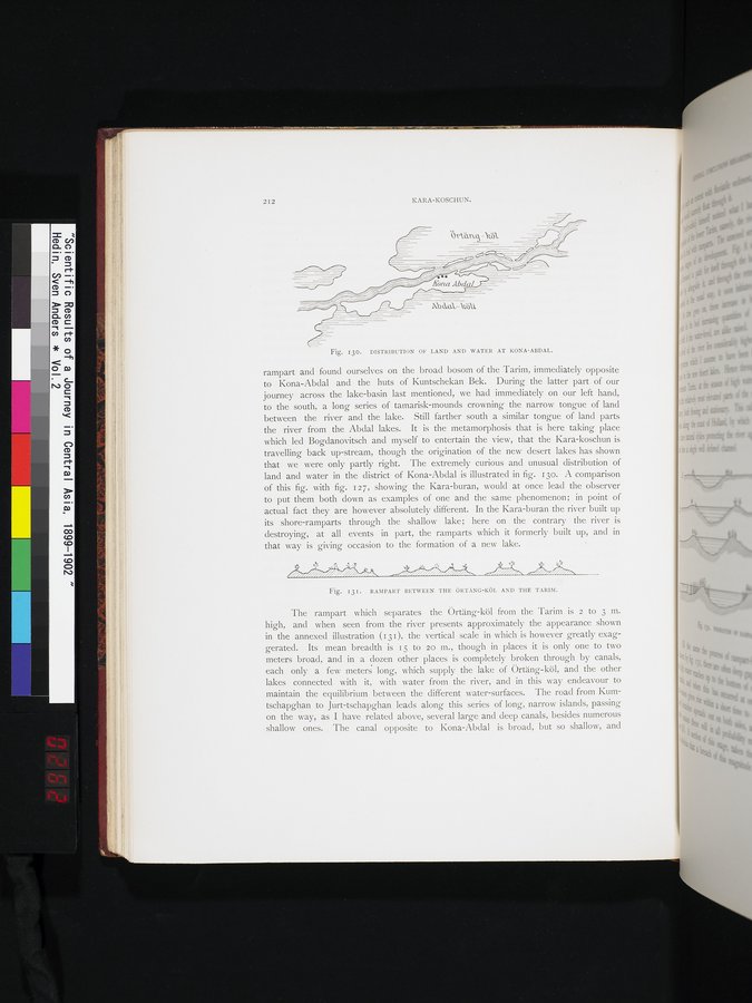 |
| コナ・アブダルの陸地と湖水の分布。DISTRIBUTION OF LAND AND WATER AT KONA-ABDAL. | |
| ウルテン・クルとタリム川との間の山の背。RAMPART BETWEEN THE ÖRTÄNG-KÖL AND THE TARIM. |
2I2 KARA-KOSCHUN.
Fig. 130. DISTRIBUTION OF LAND AND WATER AT KONA-ABDAL.
rampart and found ourselves on the broad bosom of the Tarim, immediately opposite to Kona-Abdal and the huts of Kuntschekan Bek. During the latter part of our journey across the lake-basin last mentioned, we had immediately on our left hand, to the south, a long series of tamarisk-mounds crowning the narrow tongue of land between the river and the lake. Still farther south a similar tongue of land parts the river from the Abdal lakes. It is the metamorphosis that is here taking place which led Bogdanovitsch and myself to entertain the view, that the Kara-koschun is travelling back up-stream, though the origination of the new desert lakes has shown that we were only partly right. The extremely curious and unusual distribution of land and water in the district of Kona-Abdal is illustrated in fig. 13o. A comparison of this fig. with fig. 127, showing the Kara-buran, would at once lead the observer to put them both down as examples of one and the sanie phenomenon; in point of actual fact they are however absolutely different. In the Kara-buran the river built up its shore-ramparts through the shallow lake; here on the contrary the river is destroying, at all events in part, the ramparts which it formerly built up, and in that way is giving occasion to the formation of a new lake.
p r•
/~.r9///i./.rï/JiS. ___,ri~/~~V~~/S7/~..Vl/i ~/.... ,..,G%I// . _.ii/, /~.l~i.CCi..
Fig. 131. RAMPART BETWEEN THE ÖRT ÄNG-KöL AND THE TARIM.
The rampart which separates the Örtäng-köl from the Tarim is 2 tO 3 m. high, and when seen from the river presents approximately the appearance shown in the annexed illustration (13 I), the vertical scale in which is however greatly exaggerated. Its mean breadth is 15 to 20 Ill., though in places it is only one to two meters broad, and in a dozen other places is completely broken through by canals, each only a few meters long, which supply the lake of Örtäng-köl, and the other lakes connected with it, with water from the river, and in this way endeavour to maintain the equilibrium between the different water-surfaces. The road from Kumtschapghan to Jurt-tschapghan leads along this series of long, narrow islands, passing on the way, as I have related above, several large and deep canals, besides numerous shallow ones. The canal opposite to Kona-Abdal is broad, but so shallow, and
|
Copyright (C) 2003-2019
National Institute of Informatics(国立情報学研究所)
and
The Toyo Bunko(東洋文庫). All Rights Reserved.
本ウェブサイトに掲載するデジタル文化資源の無断転載は固くお断りいたします。