国立情報学研究所 - ディジタル・シルクロード・プロジェクト
| |||||||||
|
| Scientific Results of a Journey in Central Asia, 1899-1902 : vol.2 | |
| 1899-1902年の中央アジア旅行における科学的成果 : vol.2 |
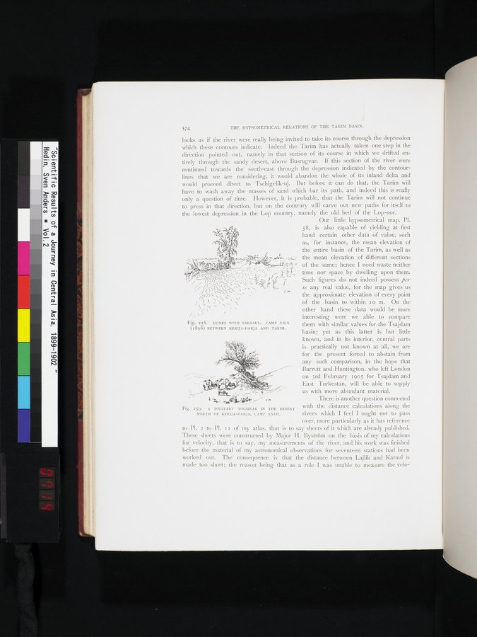 |
| サクサウルと砂丘。第29キャンプ(1896年)。ケリヤ・ダリヤとタリム川の中間にて。DUNES WITH SAKSAUL. CAMP XXIX (1896) BETWEEN KERIJA-DARJA AND TARIM. | |
| ケリヤ・ダリヤ北の砂漠にある独立したトグラクの木、第27キャンプ。A SOLITARY TOGHRAK IN THE DESERT NORTH OF KERIJA-DARJA, CAMP XXVII. |
574 THE HYPSOMETRICAL RELATIONS OF THE TARIM BASIN.
looks as if the river were really being invited to take its course through the depression which these contours indicate. Indeed the Tarim has actually taken one step in the direction pointed out, namely in that section of its course in which we drifted entirely through the sandy desert, above Busrugvar. If this section of the river were continued towards the south-east through the depression indicated by the contour-lines that we are considering, it would abandon the whole of its inland delta and would proceed direct to Tschigelik-uj. But before it can do that, the Tarim will have to wash away the masses of sand which bar its path, and indeed this is really only a question of time. However, it is probable; that the Tarim will not continue to press in that direction, but on the contrary will carve out new paths for itself to the lowest depression in the Lop country, namely the old bed of the Lop-nor.
Our little hypsometrical map, Pl. 58, is also capable of yielding at first hand certain other data of value, such
!4 as, for instance, the mean elevation of
the entire basin of the Tarim, as well as
~* , ~ ; ..; -~ the mean elevation of different sections
r, J. '-q'' ' :'., ”:4 of the same; hence I need waste neither
f~ > :41//,/,'.ç,';','•;;,;~fr ,`, -.1', f, time nor space by dwelling upon them.
- Such figures do not indeed possess per
- se any real value, for the map gives us• /?Sç::
/, f
t - , ,-. jht ,,; ` t -ï - ` ' the approximate elevation of every point
(< <) . ti of the basin to within 1 o m. On the
S ( (ç ` ? - other hand these data would be more
interesting were we able to compare
them with similar values for the Tsajdam basin; yet as this latter is but little known, and in its interior, central parts
,l';~,, ; is practically not known at all, we are
~~ ' ' for the present forced to abstain from
,y -rr- P
' ■ ‘•' .`'°` any such comparison, in the hope that
`• '. ' ' Barrett and Huntington, who left London
Fig. 258. DUNES WITH SAKSAUL. CAMP XXIX
(1896) BETWEEN KERIJA-DARJA AND TARIM.
on 3rd February 1905 for Tsajdam and East Turkestan, will be able to supplyus with more abundant material.
•
~. _ .• r.. s" There is another question connected
Fig.2 with the distance calculations along the
59 A SOLITARY TOGHRAK IN THE DESERT
NORTH OF KERIJA-DARJA, CAMP XXVII. rivers which I feel I ought not to pass
over, more particularly as it has reference to PI. 2 to Pl. II of my atlas, that is to say sheets of it which are already published. These sheets were constructed by Major H. Byström on the basis of my calculations for velocity, that is to say, my measurements of the river, and his work was finished before the material of my astronomical observations for seventeen stations had been worked out. The consequence is that the distance between Lajlik and Karaul is made' too short; the reason being that as a rule I was unable to measure the velo-
|
Copyright (C) 2003-2019
National Institute of Informatics(国立情報学研究所)
and
The Toyo Bunko(東洋文庫). All Rights Reserved.
本ウェブサイトに掲載するデジタル文化資源の無断転載は固くお断りいたします。