国立情報学研究所 - ディジタル・シルクロード・プロジェクト
| |||||||||
|
| Scientific Results of a Journey in Central Asia, 1899-1902 : vol.2 | |
| 1899-1902年の中央アジア旅行における科学的成果 : vol.2 |
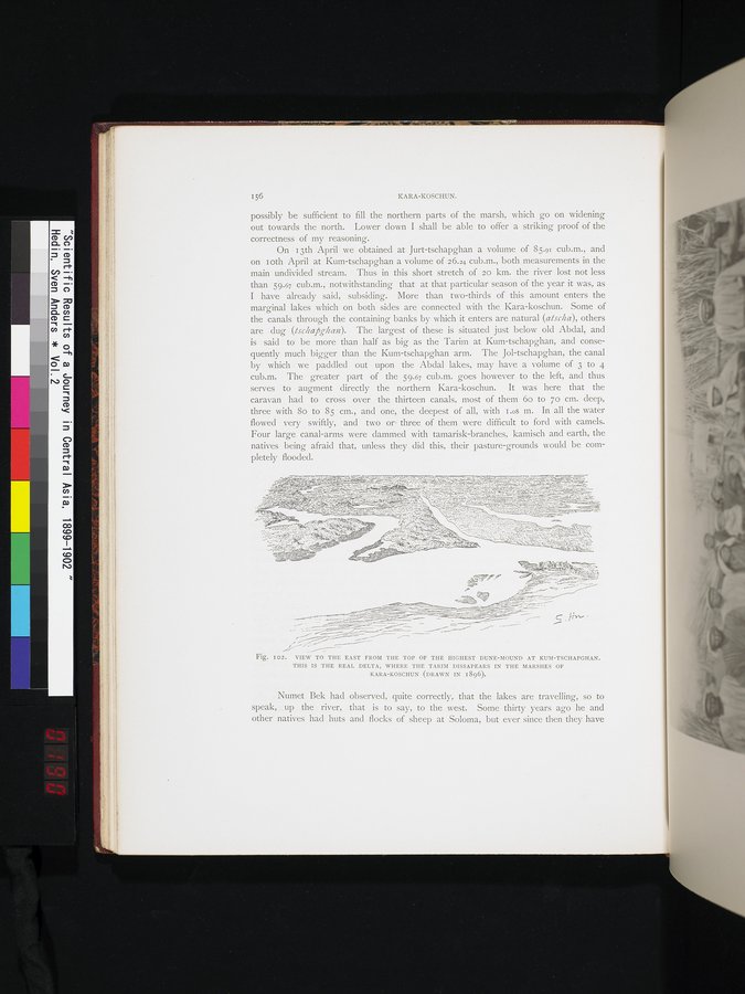 |
| クム・チャプガンの最も高い砂丘の頂上より東方の景観。これは、タリム川がカラ・コシュンの沼沢地の中に消えていく、実際のデルタである。(1896年に作図)。VIEW TO THE EAST FROM THE TOP OF THE HIGHEST DUNE-MOUND AT KUM-TSCHAPGHAN. THIS IS THE REAL DELTA, WHERE THE DISSAPEARS IN THE MARSHES OF KARA-KOSCHUN (DRAWN IN 1896). |
156
KARA-KOSCHUN.
possibly be sufficient to fill the northern parts of the marsh, which go on widening out towards the north. Lower down I shall be able to offer a striking proof of the correctness of my reasoning.
On I 3th April we obtained at Jurt-tschapghan a volume of 85.91 cub.m., and on Loth April at Kum-tschapghan a volume of 26.24 cub.m., both measurements in the main undivided stream. Thus in this short stretch of 20 km. the river lost not less than 59.67 cub.m., notwithstanding that at that particular season of the year it was, as I have already said, subsiding. More than two-thirds of this amount enters the marginal lakes which on both sides are connected with the Kara-koschun. Some of the canals through the containing banks by which it enters are natural (atscha), others are dug (tschapghan). The largest of these is situated just below old Abdal, and is said to be more than half as big as the Tarim at Kum-tschapghan, and consequently much bigger than the Kum-tschapghan arm. The Jol-tschapghan, the canal by which we paddled out upon the Abdal lakes, may have a volume of 3 to 4 cub.m. The greater part of the 59.67 cub.m. goes however to the left, and thus serves to augment directly the northern Kara-koschun. It was here that the caravan had to cross over the thirteen canals, most of them 6o to 7o cm. deep, three with 8o to 85 cm., and one, the deepest of all, with I.o8 m. In all the water flowed very swiftly, and two or three of them were difficult to ford with camels. Four large canal-arms were dammed with tamarisk-branches, kamisch and earth, the natives being afraid that, unless they did this, their pasture-grounds would be completely flooded.
.~ r.~ -
.. ~~ -.. 4.-_ . _ -.~ar.+- ` `~`~ •-sc
'Y-~ ~__:.Y'~•-,(...}` ~jQ . : w. ~ Ç+.w~~~~~:~i~~~..t
_ ` ~ _ ~- •" 'n~_y 4 Y~.~ ~ ~•. _ 2.:. ~~..Y.~ .. ^N.T' -i~~A~~
~..T
- .~.j. ':si.~: ,,tty',f~~ +~' ~R'- ~ -•s.; :~. ~.- .. sl _~ ,_~jK~
....Ÿ. ~ '~~'~ , il. .~ ,~. ~ •';^w.._..~::`.... _•,~N __. .ÿ I YI
~..~.::ir.Y~~.t:i..^,;i• `~7~'.. —~3-'"~ _~•.~~-~q.'"T~`~. 1.:~1~\~ 1.:.^ ~ ^ • h II.C:~fq~.V1•,~ rl
, i~~ •~~~, l~b 41y~
,~•....., ~,,. i.,•,l,• ~••
~~~,,....
••~~~-"`~-~`.~?~=i ~ ..__ r'.L,.~ `~r•.•e.a~$: ~;~,` t6~:~' , .
c. •
Fig. IO2. VIEW TO THE EAST FROM THE TOP OF THE HIGHEST DUNE-MOUND AT KUM-TSCHAPGHAN.
THIS IS THE REAL DELTA, WHERE THE TARIM DISSAPEARS IN THE MARSHES OF
KARA-KOSCHUN (DRAWN IN 1896).
Numet Bek had observed, quite correctly, that the lakes are travelling, so to speak,. up the river, that is to say, to the west. Some thirty years ago he and other natives had huts and flocks of sheep at Soloma, but ever since then they have
|
Copyright (C) 2003-2019
National Institute of Informatics(国立情報学研究所)
and
The Toyo Bunko(東洋文庫). All Rights Reserved.
本ウェブサイトに掲載するデジタル文化資源の無断転載は固くお断りいたします。