国立情報学研究所 - ディジタル・シルクロード・プロジェクト
| |||||||||
|
| Scientific Results of a Journey in Central Asia, 1899-1902 : vol.2 | |
| 1899-1902年の中央アジア旅行における科学的成果 : vol.2 |
 |
| 断面図Vertical section |
580 THE HYPSOMETRICAL RELATIONS OF THE TARIM BASIN.
Avullu-köl 6.10 m.
Kara-köl 6.52 »
Tajek-köl 9.52 »
Arka-köl 7.13 »
Tschivilik-köl 5•15 »
Ilek 12.55 »
Arghan 8.22 »
Tarim at Jangi-uj (1 896) 8.8o »
Kara-koschun 5.15 »
This brings us to the consideration of the parallelogram I have mentioned. Its western side, from Tajek-köl to Tschigelik-uj, measures 81 km., or the same length as the line we surveyed. On PI. 61 (a) a we have a profile of the line AB with the depths sounded. Tschigelik-uj (819 m.) lies 9 m. lower than the Tajek-köl (828 m.), but the bottom of the Tarim (5.o6 m. deep) lies only 41/2 m. lower than the bottom of the Tajek-köl (9,52 m.). Thus the bottom of the Tajek-köl lies half a meter lower
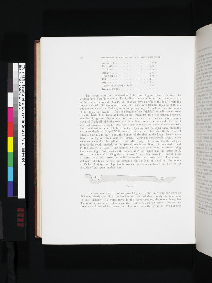
than the bank of the Tarim at Tschigelik-uj. But as the Tajek-köl certainly possesses considerably greater depths than 9.52. m., and since the Tarim in several places north of Tschigelik-uj is shallower than it is there, we may even speak of a rise of the bed towards the south. And this becomes indeed quite certain when we take into consideration the stretch between the Tajek-köl and the Lajlik-darja, where the maximum depth at Camp XXXII amounted to 2.26 m. Thus while the difference of altitude amounts to only 5 m., the bottom of the river at the latter place is more than 2 m. higher than it is at the former. Along this considerable stretch, which embraces more than the half of the line AB, it may truly be said that the bed rises towards the south, precisely as the ground does in the Desert of Tschertschen and in the Desert of Gobi. The position will be made clear from the accompanying illustration (fig. 26o), in which the surface at A lies higher than the surface at B, • so that the water after filling the depression A must flow down to B, but in point of actual fact the bottom at A lies lower than the bottom at B. The absolute difference • of altitude between the bottom of the Ilek (12.55 m. depth) and the bottom at Tschigelik-uj (5.o6 m. depth) only amounts to 1.51 m., although the difference of altitude of the banks reaches 9 m.
The southern side, BC, of our parallelogram is also interesting, for there we find very clearly (see PI. 61 (a) b and c), that the bed does actually rise from west to east, although the water flows in the same direction, the reason being that Tschigelik-uj lies 3 m. higher than the level of the Kara-koschun. But the two profiles speak indeed for themselves. The four years that intervene have not been
Fig. 26o.
|
Copyright (C) 2003-2019
National Institute of Informatics(国立情報学研究所)
and
The Toyo Bunko(東洋文庫). All Rights Reserved.
本ウェブサイトに掲載するデジタル文化資源の無断転載は固くお断りいたします。