国立情報学研究所 - ディジタル・シルクロード・プロジェクト
| |||||||||
|
| Scientific Results of a Journey in Central Asia, 1899-1902 : vol.2 | |
| 1899-1902年の中央アジア旅行における科学的成果 : vol.2 |
 |
| 砂漠の断面Vertical sections of desert | |
| 砂漠の断面Vertical sections of desert |
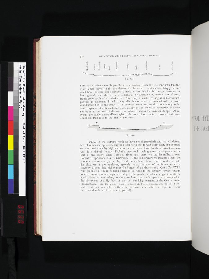
500 THE CENTRAL ASIAN DESERTS, SAND-DUNES, AND SANDS.
| âô• o N ti X V N V a :°. ~ n. c 4 F Â r cn | Depression. | ui a ~ ~ | v ~ | Mountains. |
Fig. 233.
Both sets of phenomena lie parallel to one another; from this we may infer that the winds which prevail in the two deserts are the same. Next comes, sharply demarcated from the zone just described, a more or less thin kamisch steppe, growing on level ground; and this in turn is followed by another very narrow belt of sand, immediately south of Atschik-kucluk. After only a single crossing it is however impossible to determine in what way this belt of sand is connected with the more considerable belt to the south. It is however almost certain that both belong to the same expanse of drift-sand, and consequently are in unbroken connection one with the other to the west of the route we followed across the kamisch steppe. At all events the sandy desert (Kum-tagh) to the west of our route is broader and more developed than it is to the east of the same.
Finally, in the extreme north we have the characteristic and sharply defined belt of kamisch steppe, stretching from east-north-east to west-south-west, and bounded on north and south by high sharp-cut clay terraces. How far these extend east and west it is difficult to say. Probably they attain their greatest development in the part of the desert where I crossed them, and there too the flat gulley, a deep elongated depression, is at its narrowest. At the points where we measured them, the northern terrace was 34.5 m. high and the southern 26 m. But if to this we add the elevation of the up-sloping gravelly scree, the base of the former terrace is relatively a good deal higher than the bottom of the depression at Camp No. CXLI. And probably a similar addition ought to be made to the southern terrace, though to what extent was not apparent owing to the gentle fall of the steppe towards the north. Both terraces belong to the same level, and would appear to correspond to the shore-lines of a big bay of the last surviving remnant of the Central Asian Mediterranean. At the point where I crossed it, the depression was I o to I I km. wide, and thus resembled a flat valley or immense river-bed (see fig. 234, where the vertical scale is of course exaggerated).
S N
~
Fig. 234.
|
Copyright (C) 2003-2019
National Institute of Informatics(国立情報学研究所)
and
The Toyo Bunko(東洋文庫). All Rights Reserved.
本ウェブサイトに掲載するデジタル文化資源の無断転載は固くお断りいたします。