国立情報学研究所 - ディジタル・シルクロード・プロジェクト
| |||||||||
|
| Scientific Results of a Journey in Central Asia, 1899-1902 : vol.2 | |
| 1899-1902年の中央アジア旅行における科学的成果 : vol.2 |
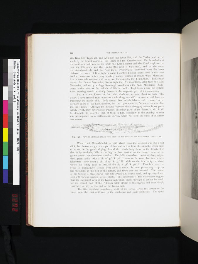 |
| アルトミシュ・ブラク、クルク・ターグの山麓にあるオアシスの景観。北東を望む。VIEW OF ALTMISCH-BULAK, THE OASIS AT THE FOOT OF THE KURUK-TAGH LOOKING NE. |
222 THE DESERT OF LOP.
köl, Kara-köl, Tajek-köl, and Arka-köl, the lower Ilek, and the Tarim, and on the south by the lowest course of the Tarim and the Kara-koschun. The boundaries of the south-east half are, on the north the Kara-koschun and the Kuruk-tagh, on the east the Chara-nor and the Tan-ho (the river of Sa-tscheo), and on the south the Anambaruin-ula and the Astin-tagh. Prschevalskij bestowed upon the latter division the name of Kum-tagh, a name I confess I never heard used in that connection; moreover it is a very unlikely name, because it means »Sand Mountain», i. e. a mountain covered with sand, as, for example, the Tekija-tagh. Tschöl-tagh means the Desert Mountains, Kuruk-tagh the Dry Mountains, Altin-tagh the Gold Mountains, and so by analogy Kum-tagh would mean the Sand Mountains. Sanddunes which rise to the altitude of hills are called Tagh-kum, where the syllable kacm, meaning »sand» or »sandy desert», is the emphatic part of the compound.
But it is the Desert of Lop with which we are now about to deal. This desert I have crossed from north to south along two different routes, both however traversing the middle of it. Both started from Altmisch-bulak and terminated at the northern shore of the Kara-koschun, but the i 90o route lay farther to the west than the i 90I route. Although the distance between these diverging routes is not particularly great, they nevertheless traverse dissimilar parts of the desert, so that it will be desirable to describe each of them in turn, especially as the crossing in 19o1 was accompanied by a mathematical survey, which will form the basis of important conclusions.
~.~--Ma
,,
y,.;.~
Fig. 135. VIEW OF ALTMISCH-BULAK, THE OASIS AT THE FOOT OF THE KURUK-TAGH LOOKING NE.
When I left Altmisch-bulak on 27th March 1900 the ice-sheet was still a foot thick, but before we got a couple of hundred meters from the oasis the brook came to an end in the gently sloping channel that winds lazily down to the desert. It is shut in by bordering hills, Io m. high at first, vertical on the concave sides of the gentle curves, but elsewhere rounded. The hills themselves consist of sharp-edged, dark green schists, with a dip of 49° S. 3o° E. near to the oasis, but two or three kilometers lower down a dip of 17° S. 3o° E., while on the little rocky threshold, where the spring itself is situated the dip is 58° S. 3o° E. That is to say, the rocks lie increasingly steeper from south to north. In some places they crop out like thresholds in the bed of the torrent, and there they are rounded. The bottom of the torrent is hard, strewn with fine gravel and coarse sand, and sparsely dotted over with various scrubby steppe plants. The dimensions of this watercourse suggest that the catchment area of the Kuruk-tagh which drains through it cannot be small; for the eroded bed of the Altmisch-bulak stream is the biggest and most deeply excavated of any in this part of the Kuruk-tagh.
The little threshold immediately south of the spring forces the torrent to deviate from the east-south-east to the south-east and south-south-east. The space
|
Copyright (C) 2003-2019
National Institute of Informatics(国立情報学研究所)
and
The Toyo Bunko(東洋文庫). All Rights Reserved.
本ウェブサイトに掲載するデジタル文化資源の無断転載は固くお断りいたします。