国立情報学研究所 - ディジタル・シルクロード・プロジェクト
| |||||||||
|
| Scientific Results of a Journey in Central Asia, 1899-1902 : vol.2 | |
| 1899-1902年の中央アジア旅行における科学的成果 : vol.2 |
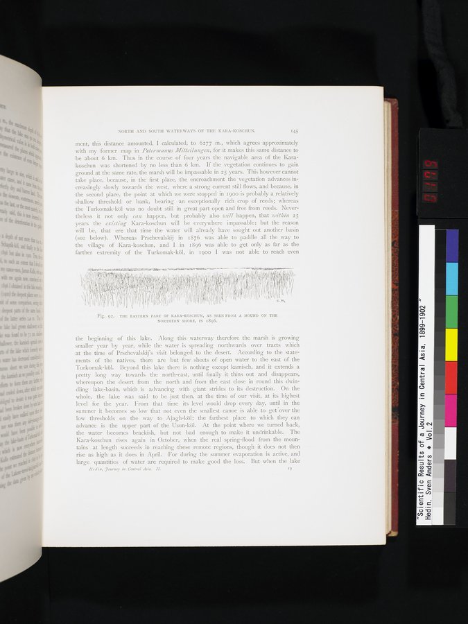 |
| 1896年に北岸の土手から見た、カラ・コシュンの東部。THE EASTERN PART OF KARA-KOSCHUN, AS SEEN FROM A MOUND ON THE NORTHERN SHORE, IN 1896. |
NORTH AND SOUTH WATERWAYS OF THE KARA-KOSCHUN. 145
ment, this distance amounted, I calculated, to 6277 m., which agrees approximately with my former map in Petermanns Mitteilungen, for it makes this same distance to be about 6 km. Thus in the course of four years the navigable area of the Karakoschun was shortened by no less than 6 km. If the vegetation continues to gain ground at the same rate, the marsh will be impassable in 25 years. This however cannot take place, because, in the first place, the encroachment the vegetation advances increasingly slowly towards the west, where a strong current still flows, and because, in the second place, the point at which we were stopped in 1900 is probably a relatively shallow threshold or bank, bearing an exceptionally rich crop of reeds; whereas the Turkomak-köl was no doubt still in great part open and free from reeds. Nevertheless it not only can happen, but probably also will happen, that within 25 years the existing Kara-koschun will be everywhere impassable; but the reason will be, that ere that time the water will already have sought out another basin (see below). Whereas Prschevalskij in 1876 was able to paddle all the way to the village of Kara-koschun, and I in i896 was able to get only as far as the farther extremity of the Turkomak-köl, in 1 goo I was not able to reach even
,u t 1 qu~ •y,Lypy4yyp~lp~l{IiiluNtUPywiatu~.nr~ y~Gi'vt•~ 4tä- s... :it~'PP0111-'1 tr (~W~l ~''~,l~i (i
i~ 4
~~ 1 ~ r 4~d11 `
~ {11(+I+'I,RI~I'~t ~ ~ ~ ► < ,~~
Fig. 92. THE EASTERN PART OF KARA-KOSCHUN, AS SEEN FROM A MOUND ON THE
NORTHERN SHORE, IN 1896.
the beginning of this lake. Along this waterway therefore the marsh is growing smaller year by year, while the water is spreading northwards over tracts which at the time of Prschevalskij's visit belonged to the desert. According to the statements of the natives, there are but few sheets of open water to the east of the Turkomak-köl. Beyond this lake there is nothing except kamisch, and it extends a pretty long way towards the north-east, until finally it thins out and disappears, whereupon the desert from the north and from the east close in round this dwindling lake-basin, which is advancing with giant strides to its destruction. On the whole, the lake was said to be just then, at the time of our visit, at its highest level for the year. From that time its level would drop every day, until in the summer it becomes so low that not even the smallest canoe is able to get°over the low thresholds on the way to Ajagh-köl; the farthest place to which they can advance is the upper part of the Usun-köl. At the point where we turned back, the water becomes brackish, but not bad enough to make it undrinkable. The Kara-koschun rises again in October, when the real spring-flood from the mountains at length succeeds in reaching these remote regions, though it does not then rise as high as it does in April. For during the summer evaporation is active, and large quantities of water are required to make good the loss. But when the lake
Hedin, journey in Central Asia. H. 19
|
Copyright (C) 2003-2019
National Institute of Informatics(国立情報学研究所)
and
The Toyo Bunko(東洋文庫). All Rights Reserved.
本ウェブサイトに掲載するデジタル文化資源の無断転載は固くお断りいたします。